Troistedt | |
|---|---|
 Coat of arms | |
Location of Troistedt | |
 Troistedt 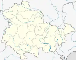 Troistedt | |
| Coordinates: 50°56′20″N 11°14′42″E / 50.93889°N 11.24500°E | |
| Country | Germany |
| State | Thuringia |
| District | Weimarer Land |
| Municipality | Grammetal |
| Area | |
| • Total | 9.28 km2 (3.58 sq mi) |
| Elevation | 354 m (1,161 ft) |
| Population (2018-12-31) | |
| • Total | 188 |
| • Density | 20/km2 (52/sq mi) |
| Time zone | UTC+01:00 (CET) |
| • Summer (DST) | UTC+02:00 (CEST) |
| Postal codes | 99438 |
| Dialling codes | 03643 |
| Vehicle registration | AP |
Troistedt is a village and a former municipality in the Weimarer Land district of Thuringia, Germany. Since December 2019, it is part of the municipality Grammetal.
References
This article is issued from Wikipedia. The text is licensed under Creative Commons - Attribution - Sharealike. Additional terms may apply for the media files.