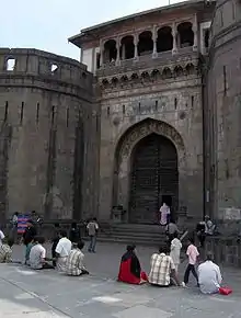
The Pune metropolitan area consists of:[1]
Old city
This area consists of areas which were part of Pune before the arrival of the British in 1818. This area consists of 17 peths. This area is today called as Old city.
Other areas under PMC Administration
In the late 19th century, Pune city started expanding and nearby villages were absorbed into Pune Municipal Corporation. The earliest villages were Shivajinagar, Parvati, Wanwadi and Yerwada. As of 2018, below villages have been absorbed in the city.
- Ambegaon Budruk
- Aundh
- Baner
- Bavdhan Khurd
- Bavdhan Budruk
- Balewadi
- Shivajinagar
- Bibvewadi
- Bhugaon
- Bhukum
- Dhankawadi
- Dhanori
- Dhayari
- Erandwane
- Fursungi
- Ghorpadi
- Hadapsar
- Hingne Khurd
- Karve Nagar
- Kalas
- Katraj
- Khadki
- Kharadi
- Kondhwa
- Koregaon Park
- Kothrud
- Lohagaon
- Manjri
- Markal
- Mohammed Wadi
- Mundhwa
- Nanded
- Parvati (Parvati Hill)
- Panmala
- Pashan
- Pirangut
- Shivane
- Sus
- Undri
- Vishrantwadi
- Vitthalwadi
- Vadgaon Khurd
- Vadgaon Budruk
- Vadgaon Sheri
- Wagholi
- Wanwadi
- Warje
- Yerwada
Areas under PCMC Administration
In 1970s, due to increased industrialisation on Mumbai–Pune Highway, many villages around the highway were merged to form PCMC, Pune. The earliest villages which were absorbed were Pimpri, Chinchwad, Dapodi, Bhosari etc. Till 2018, below villages have been absorbed in the city.
Areas around Vadgaon
In 1970s, due to increased industrialisation on Mumbai–Pune highway, villages around Vadgaon Maval (a taluka town in Pune district) were developed. These are:
- Ambi
- Parandwadi
- Somatne
- Talegaon
- Urse
- Vadgaon Maval
- Varale
Cantonment areas
These are the permanent military areas established by the British.
- Pune Cantonment, formed by borrowing land from the villages of Wanwadi, Ghorpadi and Munjeri.
- Khadki Cantonment, formed by borrowing land from the villages of Bopodi, Bhamburde (now called Shivajinagar) and Aundh.
- Dehu Road Cantonment, formed by borrowing land from the villages of Dehu, Kiwale, Mamurdi and others.
References
- ↑ "Housing Report" (PDF).
