Vérteskethely | |
|---|---|
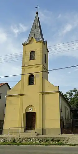 The Lutheran church | |
 Flag  Coat of arms | |
 Vérteskethely Location of Vérteskethely | |
| Coordinates: 47°29′14″N 18°05′00″E / 47.48721°N 18.08347°E | |
| Country | |
| County | Komárom-Esztergom |
| Area | |
| • Total | 17.48 km2 (6.75 sq mi) |
| Population (2004) | |
| • Total | 597 |
| • Density | 34.15/km2 (88.4/sq mi) |
| Time zone | UTC+1 (CET) |
| • Summer (DST) | UTC+2 (CEST) |
| Postal code | 2859 |
| Area code | 34 |
Vérteskethely is a village in Komárom-Esztergom county, Hungary.
External links
- Street map (in Hungarian)
This article is issued from Wikipedia. The text is licensed under Creative Commons - Attribution - Sharealike. Additional terms may apply for the media files.