| Vedea | |
|---|---|
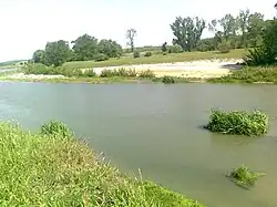
 Vedea in 2011, near Peretu | |
 | |
| Location | |
| Country | Romania |
| Counties | Argeș, Olt, Teleorman |
| Towns | Roșiorii de Vede, Alexandria |
| Physical characteristics | |
| Source | Dădulești Hill |
| • location | Cotmeana Plateau |
| • elevation | 435 m (1,427 ft) |
| Mouth | Danube |
• location | Bujoru |
• coordinates | 43°39′13″N 25°31′35″E / 43.65361°N 25.52639°E |
• elevation | 20 m (66 ft) |
| Length | 224 km (139 mi) |
| Basin size | 5,430 km2 (2,100 sq mi) |
| Basin features | |
| Progression | Danube→ Black Sea |
| Tributaries | |
| • left | Teleorman |
The Vedea (Romanian pronunciation: [ˈvede̯a]) is a river in southern Romania that flows from the Cotmeana Plateau and empties into the Danube.[1][2] It has a total length of 224 km,[2] of which 33 km is regulated. Its drainage basin area is 5,430 km2.[2][3]
It flows in Argeș, Olt and Teleorman counties. The towns Alexandria and Roșiorii de Vede lie in the vicinity of the river.
The name of the river is Dacian in origin, from Indo-European *wed, "water".[4][5]
Towns and villages
The following towns and villages are situated along the river Vedea, from source to mouth: Făgețelu, Spineni, Tătulești, Optași, Corbu, Nicolae Titulescu, Văleni, Stejaru, Roșiorii de Vede, Vedea, Peretu, Plosca, Mavrodin, Buzescu, Alexandria, Poroschia, Brânceni, Smârdioasa, Cervenia, Conțești, Bragadiru, Bujoru.
Tributaries
The following rivers are tributaries of the Vedea (from source to mouth):[2]
References
- ↑ "Planul național de management. Sinteza planurilor de management la nivel de bazine/spații hidrografice, anexa 7.1" (PDF, 5.1 MB). Administrația Națională Apele Române. 2010. pp. 740–743.
- 1 2 3 4 Atlasul cadastrului apelor din România. Partea 1 (in Romanian). Bucharest: Ministerul Mediului. 1992. pp. 315–320. OCLC 895459847. River code: IX.1
- ↑ 2017 Romanian Statistical Yearbook, p. 13
- ↑ Katičić, Radislav. Ancient Languages of the Balkans, Part One. Paris: Mouton, 1976: 147
- ↑ Istoria râului Vedea (archive)
