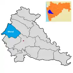
Villages in Mawal taluka | |
|---|---|
 Location of Mawal in Pune district in Maharashtra | |
| Country | |
| State | Maharashtra |
| District | Pune district |
| ISO 3166 code | ISO 3166-2:IN |
Mawal taluka, whose name is also spelled as Maval, is an administrative area of Pune district, in the state of Maharashtra, India. At the time of the 2011 Census of India, it comprised 187 villages, a figure that was unchanged from 2001.[1] Among those were the six uninhabited villages of Nandgaon, Jevare, Budhele, Pale Pawan Mawal, Shevati and Phagane.[2]
A
B
C
D
G
I
J
K
- Kacharewadi
- Kadadhe
- Kadav
- Kale
- Kalhat
- Kambare Andar Mawal
- Kambare Nane Mawal
- Kamshet
- Kanhe
- Karandoli
- Karanjgaon
- Karla
- Karunj
- Kashal
- Katavi
- Keware
- Khand
- Khandashi
- Kivale
- Kolechafesar
- Kondivade Andar Mawal
- Kondivade Nane Mawal
- Kothurne
- Kune Ansute
- Kune Nane Mawal
- Kurvande
- Kusavali
- Kusgaon Khurd
- Kusgaon Pawan Mawal
- Kusur
L
M
N
O
P
R
S
T
U
V
W
Y
References
- ↑ "Census of India 2011: Maharashtra: District Census Handbook Part B: Pune" (PDF). Directorate of Census Operations. p. 10. Archived from the original (PDF) on 11 March 2016. Retrieved 19 May 2019.
- ↑ "Census of India 2011: Maharashtra: District Census Handbook Part B: Pune" (PDF). Directorate of Census Operations. pp. 408, 414. Archived from the original (PDF) on 11 March 2016. Retrieved 19 May 2019.
This article is issued from Wikipedia. The text is licensed under Creative Commons - Attribution - Sharealike. Additional terms may apply for the media files.