Voćin | |
|---|---|
Village | |
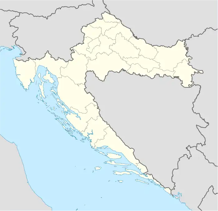
 Voćin Location of Voćin in Croatia | |
| Coordinates: 45°37′04″N 17°32′52″E / 45.61778°N 17.54778°E | |
| Country | |
| Region | Continental Croatia |
| County | |
| Municipality | Voćin |
| Area | |
| • Village | 296.6 km2 (114.5 sq mi) |
| • Urban | 54.5 km2 (21.0 sq mi) |
| Elevation | 215 m (705 ft) |
| Population (2021)[2] | |
| • Village | 1,896 |
| • Density | 6.4/km2 (17/sq mi) |
| • Urban | 956 |
| • Urban density | 18/km2 (45/sq mi) |
| Time zone | UTC+1 (CET) |
| • Summer (DST) | UTC+2 (CEST) |
| Postal code | 33522 |
| Area code | (+385) 33 |
| Website | vocin |
Voćin is a village and municipality in western Slavonia, Croatia, located southwest of Slatina and east of Daruvar. The population of the municipality is 1,911, with 956 people living in Voćin itself (census 2021).
Geography
Voćin, a pilgrimage site, is located in a valley of the Voćinska Rijeka at the foot of Papuk Mountain. The surrounding area is notable for the Lisičine arboretum, the special Sekulinačke Planine forest vegetation reserve.
History

.JPG.webp)
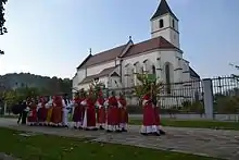
In the late 19th and early 20th century, Voćin was part of the Virovitica County of the Kingdom of Croatia-Slavonia. The church was destroyed during World War II and rebuilt in 1973.
During the World War II, on January 14, 1942, happened the first Voćin massacre - killing of 350 Serb civilians by the Croatian Ustaše. The massacre was carried out as retaliation for partisans' action in Papuk.[3]
During the Croatian War of Independence, the village's was the site of a massacre by the Serb White Eagles, who killed 43 villagers, all but one of whom were ethnic Croats.[4][5] A Serb civilian who tried to protect his neighbors was the other fatality. Overnight, between 13 and 14 December 1991, the village's 550-year-old late style gothic church of the Visitation of the Blessed Virgin Mary was destroyed by explosive charges.[4] Following the withdrawal of the Serb forces and arrival of Croatian forces, crimes against the Serb civilian population who stayed behind took place, with some 40 villagers killed over the course of several days.[6]
Demographics
According to the 2021 census,[7] the Voćin municipality had 1,911 inhabitants. The municipality consists of the following settlements:
| Settlement | 1991 | 2001 | 2011 | 2021 |
|---|---|---|---|---|
| Bokane | 116 | 192 | 215 | 136 |
| Ćeralije | 284 | 597 | 623 | 595 |
| Dobrić | 64 | 4 | - | - |
| Donje Kusonje | 97 | 4 | 5 | 5 |
| Đuričić | 89 | 2 | - | - |
| Gornje Kusonje | 69 | 36 | 13 | 6 |
| Gornji Meljani | 172 | 12 | 15 | 8 |
| Hum | 243 | 102 | 90 | 62 |
| Hum Varoš | 61 | 40 | 47 | 24 |
| Kometnik-Jorgići | 119 | 58 | 26 | 27 |
| Kometnik-Zubići | 171 | 17 | 28 | 16 |
| Kuzma | 25 | - | - | - |
| Lisičine | 160 | 6 | - | - |
| Macute | 286 | 80 | 33 | 19 |
| Mačkovac | 75 | 73 | 47 | 33 |
| Novo Kusonje | 48 | 26 | 22 | 15 |
| Popovac | 43 | 2 | - | - |
| Rijenci | 120 | 7 | 5 | 3 |
| Sekulinci | 238 | 16 | 7 | 2 |
| Smude | 103 | 4 | 15 | 4 |
| Voćin | 1,569 | 1,221 | 1,191 | 956 |
| Voćin municipality | 4,152 | 2,421 | 2,384 | 1,911 |
Population of the Voćin municipality by ethnicity:[7]
| Year of census | total | Croats | Serbs | Yugoslavs | others |
|---|---|---|---|---|---|
| 2021 | 1 896 | 1784 (94.09%) | 90 (4.75%) | - | 6 (0.3%) |
| 2011 | 2 382 | 2 147 (90.13%) | 211 (8.86%) | - | 24 (1.01%) |
| 2001 | 2 421 | 2 069 (85.46%) | 315 (13.01%) | - | 37 (1.53%) |
| 1991 | 1 569 | n/a | n/a | n/a | n/a |
Population of the Voćin village by ethnicity:[7][8]
| Year of census | total | Croats | Serbs | Yugoslavs | others |
|---|---|---|---|---|---|
| 2021 | 956 | n/a | n/a | - | n/a |
| 2011 | 1 191 | 1097 (92.12%) | 79 (6.63%) | - | 15 (1.26%) |
| 2001 | 1 161 | n/a | n/a | - | n/a |
| 1991 | 1 569 | 426 (27.15%) | 1 009 (64.31%) | 65 (4.14%) | 69 (4.40%) |
| 1981 | 1 558 | 404 (25.93%) | 904 (58.02%) | 226 (14.51%) | 24 (1.54%) |
| 1971 | 1 489 | 541 (36.33%) | 869 (58.36%) | 61 (4.10%) | 18 (1.21%) |
Politics
Minority councils
Directly elected minority councils and representatives are tasked with consulting tasks for the local or regional authorities in which they are advocating for minority rights and interests, integration into public life and participation in the management of local affairs.[10] At the 2023 Croatian national minorities councils and representatives elections Serbs of Croatia fulfilled legal requirements to elect 10 members minority councils of the Municipality of Voćin.[11]
See also
References
- ↑ Register of spatial units of the State Geodetic Administration of the Republic of Croatia. Wikidata Q119585703.
- ↑ "Population by Age and Sex, by Settlements, 2021 Census". Census of Population, Households and Dwellings in 2021. Zagreb: Croatian Bureau of Statistics. 2022.
- ↑ "Sjećanje na 350 nedužnih žrtava ustaškog terora". Virovitica.net. January 15, 2013.
- 1 2 Engelberg, Stephen (19 December 1991). "Villagers in Croatia Recount Massacre by Serbian Forces". The New York Times.
- ↑ "Yugoslavia: further reports of torture and deliberate and arbitrary killings in war zones". Amnesty International. March 1992. pp. 6–7. Archived from the original on 2016-03-06. Retrieved 2013-10-14.
- ↑ "Zločini u Voćinu – Sjećanje na sve žrtve" (PDF). documenta.hr. 13 December 2013. Archived from the original (PDF) on 21 September 2018.
- 1 2 3 4 "Population by Age and Sex, by Settlements, 2011 Census: Voćin". Census of Population, Households and Dwellings 2011. Zagreb: Croatian Bureau of Statistics. December 2012.
- ↑ Izdanje Državnog zavoda za statistiku RH: Narodnosni sastav stanovništva RH od 1880-1991. godine.
- ↑ Naselja i stanovništvo Republike Hrvatske 1857-2001, www.dzs.hr
- ↑ "Manjinski izbori prve nedjelje u svibnju, kreću i edukacije". T-portal. 13 March 2023. Retrieved 10 June 2023.
- ↑ "Informacija o konačnim rezultatima izbora članova vijeća i izbora predstavnika nacionalnih manjina 2023. X. VIROVITIČKO-PODRAVSKA ŽUPANIJA" (PDF) (in Croatian). Državno izborno povjerenstvo Republike Hrvatske. 2023. p. 16. Retrieved 10 June 2023.
- ↑ "Sjećanje na žrtve ustaškog terora / "Commemorating the victims of Ustaša terror"". portalnovosti.com (in Croatian). 14 January 2016. Retrieved 17 March 2018.
External links
45°37′04″N 17°32′52″E / 45.61778°N 17.54778°E