West Virginia Route 25 | ||||
|---|---|---|---|---|
| Route information | ||||
| Maintained by WVDOH | ||||
| Length | 12.47 mi (20.07 km) | |||
| Major junctions | ||||
| West end | ||||
| East end | ||||
| Location | ||||
| Country | United States | |||
| State | West Virginia | |||
| Counties | Putnam, Kanawha | |||
| Highway system | ||||
| ||||

_at_West_Virginia_State_Route_62_(Washington_Street)_in_Charleston%252C_Kanawha_County%252C_West_Virginia.jpg.webp)
View east along WV 25 at WV 62 in Charleston
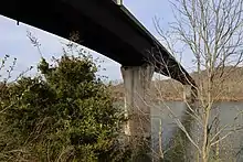
WV 25 crosses the Kanawha River at the Richard J. "Dick" Henderson Memorial Bridge between St. Albans and Nitro.
West Virginia Route 25 is an east–west state highway located within the counties of Kanawha and Putnam in the U.S. state of West Virginia. The western terminus of the route is at West Virginia Route 62 in Rock Branch (unincorporated) between the towns of Nitro and Poca. The eastern terminus is at U.S. Route 60 in Charleston.
Route Description
Major intersections
| County | Location | mi | km | Destinations | Notes |
|---|---|---|---|---|---|
| Putnam | Poca | ||||
| Nitro | I-64 exit 45 | ||||
| Kanawha | |||||
| | |||||
| Institute | I-64 exit 50 | ||||
| Dunbar | I-64 exit 53 | ||||
| 10th Street (to Dunbar Toll Bridge) | |||||
| Dunbar–Charleston line | |||||
| Charleston | |||||
| 1.000 mi = 1.609 km; 1.000 km = 0.621 mi | |||||
See also
References
External links
![]() Media related to West Virginia Route 25 at Wikimedia Commons
Media related to West Virginia Route 25 at Wikimedia Commons
This article is issued from Wikipedia. The text is licensed under Creative Commons - Attribution - Sharealike. Additional terms may apply for the media files.