Wang Thong
วังทอง | |
|---|---|
|
Seal | |
| Country | Thailand |
| Province | Phitsanulok |
| District | Wang Thong |
| Government | |
| • Type | Subdistrict administrative organization (SAO) |
| Area | |
| • Total | 58 km2 (22 sq mi) |
| Population (2022) | |
| • Total | 17,952 |
| • Density | 310/km2 (800/sq mi) |
| Time zone | UTC+7 (ICT) |
| Postal code | 65130 |
| Calling code | 055 |
| Geocode | 650801 |
| Website | www |
Wang Thong (Thai: วังทอง) is a subdistrict (tambon) in Wang Thong district, in Phitsanulok province. It lies at the intersection of Highways 11 and 12, 17 kilometres (11 mi) east of Phitsanulok city and 380 kilometres (240 mi) north of Bangkok. The economy is based on farming and animal husbandry.
History
Originally named Talat Chum, on 17 April 1939 it was renamed Wang Thong.[1] On 30 March 1996 Wang Thong subdistrict administrative organization (SAO) was established.[2]
Geography
The topography of Wang Thong subdistrict is flat plains and is located in the lower northern part of Thailand. There are mountains in the northern part of the subdistrict, such as Khao Samo Khlaeng and Khao Fa.[3] The subdistrict is bordered to the north by Samo Khae and Don Thong subdistricts, Mueang Phitsanulok district, to the east by Chaiyanam and Din Thong subdistricts, Wang Thong district, to the south by Wang Phikun subdistrict, Wang Thong district and to the west by Samo Khae subdistrict.[4] The Wang Thong River (Khek River) is the main river flowing through the subdistrict. Bueng Rachanok is a popular tourist destination. The subdistrict lies in the Nan Basin, which is part of the Chao Phraya Watershed.[3]
Administration
Central government
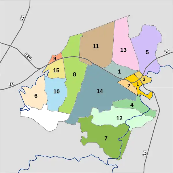
The administration of Wang Thong subdistrict is responsible for an area that covers 58 square kilometres (22 sq mi) and consists of fifteen administrative villages, as of 2022: 17,952 people.[5][6]
| Village | English | Thai | People |
|---|---|---|---|
| ----- | Ban Wang Thong | บ้านวังทอง | 418 |
| Moo1 | Ban Wang Thong | บ้านวังทอง | 1,905 |
| Moo2 | Ban Than Prong | บ้านตาลโปร่ง | 916 |
| Moo3 | Ban Nam Duan | บ้านน้ำด้วน | 1,419 |
| Moo4 | Ban Bang Saphan | บ้านบางสะพาน | 1,100 |
| Moo5 | Ban Nong Suea | หนองเสือ | 1,278 |
| Moo6 | Ban Bueng Rachanok | บ็งราชนก | 1,169 |
| M007 | Ban Wang Phrom | บ้านวังพรม | 1,176 |
| Moo8 | Ban Khao Samo Khlaeng | บ้านเขาสมอแคลง | 2,592 |
| Moo9 | Ban Suea Lak Hang | บ้านเสือลากหาง | 701 |
| Moo10 | Ban Don Muang | บ้านดอนม่วง | 607 |
| Moo11 | Ban Rong Bom | บ้านโรงบ่ม | 1,802 |
| Moo12 | Ban Wang Khrut | บ้านวังครุฑ | 763 |
| Noo13 | Ban Nam Yen | บ้านน้ำเย็น | 774 |
| Moo14 | Ban Nong Bon | บ้านหนองบอน | 905 |
| Moo15 | Ban Si Thanoothit | บ้านศรีธนูทิศ | 427 |
Local government
Wang Thong municipality is a subdistrict municipality (thesaban tambon), which covers tambon Moo1 (part east), Moo2 (Than Prong) and Moo3 (Nam Duan), with an area of 1.8 square kilometres (0.69 sq mi) with a population of 4,119.[5]
Wang Thong administrative organization (Thai: องค์การบริหารส่วนตำบลวังทอง, romanized: ongkan borihan suan tambon wangthong - abbreviated Thai: อบต.วังทอง, romanized: o bo to wangthong) is responsible for the remaining area, tambon Moo1 (part west) and Moo4 - M0015, of 56.2 square kilometres (21.7 sq mi) with a population of 13,833.[6]
Temples
Wang Thong subdistrict is home to the following active temples, where Theravada Buddhism is practiced by local residents.[7]
| Temple name | Thai | Location |
|---|---|---|
| Wat Wang Thong Wararam | วัดวังทองวราราม | Moo1 |
| Wat Bang Saphan | วัดบางสะพาน | Moo4 |
| Wat Bueng Rachanok | วัดบึงราชนก | Moo6 |
| Wat Wang Phrom | วัดวังพรม | Moo7 |
| Wat Kiri Hiranyaram | วัดคีรีหิญยาราม | Moo8 |
| Wat Phra Phutthabat Khao Samo Khlaeng | วัดพระพุทธบาทเขาสมอแคลง | Moo8 |
| Wat Wachira Thammakai | วัดวชิรธรรมาวาส | Moo8 |
| Wat Mongkon Nimit | วัดมงคลนิมิต | Moo14 |
| Wat Si Sphon | วัดศรีโสภณ | Moo15 |
Transportation
The subdistrict is the intersection of highway 11 southbound (Nakhon Sawan route), highway 12 westbound (Tak route), highway 12 eastbound (Khon Kaen route) and bypass road 126, northern ring road of Phitsanulok.
Radio
There is one radio station broadcast from Wang Thong, the Sathaanii Witthayu Ratthasaphaa (Parliament Radio Station). The frequency is 92.25 FM.[8]
References
- ↑ พระราชกฤษฎีกาเปลี่ยนนามอำเภอ กิ่งอำเภอ และตำบลบางแห่ง พุทธศักราช ๒๔๘๒ (PDF). Royal Gazette (in Thai). 56 (ก): 354–364. April 17, 1939. Archived from the original (PDF) on February 19, 2009.
- ↑ "about the subdistrict". Retrieved 20 October 2023.
- 1 2 "general condition". Retrieved 20 October 2023.
- ↑ "contact territory". Retrieved 20 October 2023.
- 1 2 "official statistics registration system". Department of Provincial Adminsitration. Retrieved 20 October 2023, >year 2022 >village level >Excel file >no.65080100-65080115 >Excel line 71094-71107
{{cite web}}: CS1 maint: postscript (link) - 1 2 "official statistics registration system". Department of Provincial Adminsitration. Retrieved 20 October 2023, >year 2022 >village level >Excel file >no.65080101-65080103 >Excel line 71434-71436
{{cite web}}: CS1 maint: postscript (link) - ↑ "list of temples". Retrieved 20 October 2023, > no.365080101 - 365080109
{{cite web}}: CS1 maint: postscript (link) - ↑ Radio Stations in Phitsanulok Province, Thailand