Weißenthurm | |
|---|---|
 Coat of arms | |
Location of Weißenthurm within Mayen-Koblenz district 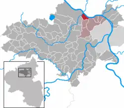 | |
 Weißenthurm 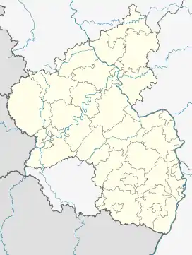 Weißenthurm | |
| Coordinates: 50°24′52″N 7°27′38″E / 50.41444°N 7.46056°E | |
| Country | Germany |
| State | Rhineland-Palatinate |
| District | Mayen-Koblenz |
| Municipal assoc. | Weißenthurm |
| Government | |
| • Mayor (2019–24) | Gerd Heim[1] (CDU) |
| Area | |
| • Total | 3.99 km2 (1.54 sq mi) |
| Elevation | 65 m (213 ft) |
| Population (2021-12-31)[2] | |
| • Total | 9,171 |
| • Density | 2,300/km2 (6,000/sq mi) |
| Time zone | UTC+01:00 (CET) |
| • Summer (DST) | UTC+02:00 (CEST) |
| Postal codes | 56575 |
| Dialling codes | 02637 |
| Vehicle registration | MYK |
| Website | www.weissenthurm.de |
Weißenthurm is a town in the district of Mayen-Koblenz, in Rhineland-Palatinate, Germany. It is situated on the left bank of the Rhine, opposite Neuwied, approximately 12 km northwest of Koblenz.
The town is spelled with an ß which may be replaced by ss if not available (Weissenthurm).
Weißenthurm is the seat of the Verbandsgemeinde ("collective municipality") Weißenthurm.
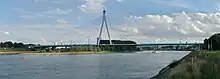
Raiffeisenbrücke between Neuwied and Weißenthurm
.JPG.webp)
The White Tower, which gave the name to Weißenthurm
References
- ↑ Direktwahlen 2019, Landkreis Mayen-Koblenz, Landeswahlleiter Rheinland-Pfalz, accessed 5 August 2021.
- ↑ "Bevölkerungsstand 2021, Kreise, Gemeinden, Verbandsgemeinden" (in German). Statistisches Landesamt Rheinland-Pfalz. 2022.
This article is issued from Wikipedia. The text is licensed under Creative Commons - Attribution - Sharealike. Additional terms may apply for the media files.