West Virginia Route 16 | ||||
|---|---|---|---|---|
| Route information | ||||
| Maintained by WVDOH | ||||
| Length | 252.9 mi[1] (407.0 km) | |||
| Major junctions | ||||
| South end | ||||
| North end | ||||
| Location | ||||
| Country | United States | |||
| State | West Virginia | |||
| Counties | McDowell, Wyoming, Raleigh, Fayette, Nicholas, Clay, Calhoun, Ritchie, Pleasants | |||
| Highway system | ||||
| ||||
_in_Arnoldsburg%252C_Calhoun_County%252C_West_Virginia.jpg.webp)
View north along WV 16 at CR 16/25 in Calhoun County

WV 16 crossing the New River in 2022

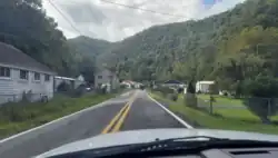
WV 16 passing through Cucumber, West Virginia
West Virginia Route 16 (WV 16) is a north–south route located in the U.S. State of West Virginia. The southern terminus of the route is at the Virginia state line in Bishop, McDowell County, where the route continues south as Virginia State Route 16. The northern terminus is at West Virginia Route 2 in St. Marys, Pleasants County, on the south bank of the Ohio River. WV 16 continues as a same-numbered route into Virginia and North Carolina, ultimately ending in Waxhaw, south of Charlotte and just north of the South Carolina border. The total length of highway is just under 475 miles (764 km) long.
Major intersections
| County | Location | mi | km | Destinations | Notes |
|---|---|---|---|---|---|
| McDowell | Bishop | Continuation from Virginia | |||
| | |||||
| Welch | south end of US 52 overlap | ||||
| north end of US 52 overlap; south end of US 52 Alt. overlap | |||||
| north end of US 52 Alt. overlap | |||||
| Wyoming | Pineville | south end of WV 10 overlap | |||
| | north end of WV 10 overlap | ||||
| Mullens | |||||
| Raleigh | | south end of WV 97 overlap | |||
| | interchange; southbound exit and northbound entrance | ||||
| MacArthur | I-77 exit 42; north end of WV 97 overlap | ||||
| Mabscott | Mabscott | interchange | |||
| Beckley | Walker Avenue | interchange; southbound access only | |||
| south end of WV 3 west overlap (northbound only) | |||||
| north end of WV 3 west overlap (northbound only) | |||||
| south end of US 19 overlap | |||||
| | interchange; north end of US 19 overlap | ||||
| Bradley | |||||
| Fayette | Mount Hope | ||||
| south end of WV 61 overlap | |||||
| | |||||
| Oak Hill | south end of US 19 overlap | ||||
| interchange; northbound exit and southbound entrance; north end of US 19 overlap | |||||
| north end of WV 61 overlap | |||||
| interchange | |||||
| Fayetteville | |||||
| Chimney Corner | south end of US 60 overlap | ||||
| Gauley Bridge | north end of US 60 overlap; south end of WV 39 overlap | ||||
| Belva | north end of WV 39 overlap | ||||
| Clay | Clay | south end of WV 4 overlap | |||
| | north end of WV 4 overlap | ||||
| | I-79 exit 40 | ||||
| Calhoun | | south end of US 33 / US 119 overlap | |||
| Millstone | north end of US 33 / US 119 overlap | ||||
| Grantsville | |||||
| Ritchie | Smithville | south end of WV 47 overlap | |||
| north end of WV 47 overlap | |||||
| Harrisville | |||||
| Ellenboro | interchange | ||||
| Pleasants | St. Marys | ||||
1.000 mi = 1.609 km; 1.000 km = 0.621 mi
| |||||
References
- ↑ Distance calculated using Microsoft MapPoint mapping software.
Wikimedia Commons has media related to West Virginia Route 16.
This article is issued from Wikipedia. The text is licensed under Creative Commons - Attribution - Sharealike. Additional terms may apply for the media files.
