| White Mountain (Idaho) | |
|---|---|
 White Mountain (Idaho) | |
| Highest point | |
| Elevation | 3,183 m (10,443 ft) |
| Prominence | 1,147 m (3,763 ft) |
| Parent peak | Peak 10620, Idaho |
| Isolation | 47.56 km (29.55 mi) |
| Coordinates | 44°34′29″N 114°29′44″W / 44.57476°N 114.49565°W |
| Geography | |
| Location | Custer County, Idaho |
| Parent range | Salmon River Mountains |
White Mountain, or White Mountain West, is the highest peak in the Salmon River Mountains in Idaho, USA, with an elevation of 10,442 feet (3,183 m).
Location
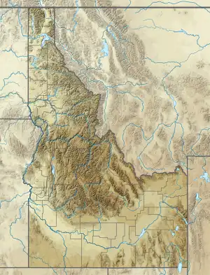
White Mountain is in Custer County, Idaho, at 44°34′29″N 114°29′44″W / 44.57476°N 114.49565°W.[1][lower-alpha 1] It is named after the bright white rock on the north and west sides of the mountain, although the summit is of gray-brown rock. It is the highest peak in the Salmon River Mountains, in the southeast of that range, with an elevation of 10,442 feet (3,183 m). It is on the edge of the Frank Church Wilderness and is administered by the Salmon-Challis National Forest.[1]
Description
White Mountain has a clear prominence of 3,762 feet (1,147 m) and isolation of 29.55 miles (47.56 km). Its nearest higher neighbor is Peak 10620, Idaho, to the ESE at 44°22′03″N 113°58′13″W / 44.367411°N 113.970193°W.[2] Class three climbing is required to reach the top. The east face is the steepest, and rises over the Twin Creek Lakes basin.[1]
Climate
The south peak of Twin Peaks (Idaho) is next to White Mountain.
| Climate data for Twin Peaks South 44.5924 N, 114.4774 W, Elevation: 9,816 ft (2,992 m) (1991–2020 normals) | |||||||||||||
|---|---|---|---|---|---|---|---|---|---|---|---|---|---|
| Month | Jan | Feb | Mar | Apr | May | Jun | Jul | Aug | Sep | Oct | Nov | Dec | Year |
| Mean daily maximum °F (°C) | 23.5 (−4.7) |
23.8 (−4.6) |
29.5 (−1.4) |
35.1 (1.7) |
44.0 (6.7) |
53.0 (11.7) |
65.2 (18.4) |
64.6 (18.1) |
55.1 (12.8) |
41.4 (5.2) |
28.3 (−2.1) |
22.1 (−5.5) |
40.5 (4.7) |
| Daily mean °F (°C) | 16.5 (−8.6) |
15.7 (−9.1) |
19.9 (−6.7) |
24.5 (−4.2) |
33.0 (0.6) |
41.4 (5.2) |
52.1 (11.2) |
51.5 (10.8) |
42.8 (6.0) |
31.3 (−0.4) |
21.1 (−6.1) |
15.4 (−9.2) |
30.4 (−0.9) |
| Mean daily minimum °F (°C) | 9.6 (−12.4) |
7.6 (−13.6) |
10.2 (−12.1) |
13.9 (−10.1) |
22.0 (−5.6) |
29.7 (−1.3) |
38.9 (3.8) |
38.3 (3.5) |
30.5 (−0.8) |
21.1 (−6.1) |
13.8 (−10.1) |
8.8 (−12.9) |
20.4 (−6.5) |
| Average precipitation inches (mm) | 3.62 (92) |
2.90 (74) |
3.42 (87) |
3.14 (80) |
2.87 (73) |
2.61 (66) |
1.11 (28) |
0.97 (25) |
1.47 (37) |
2.19 (56) |
3.07 (78) |
3.84 (98) |
31.21 (794) |
| Source: PRISM Climate Group[4] | |||||||||||||
Notes
References
- 1 2 3 4 White Mountain (ID) – SummitPost.
- 1 2 White Mountain West, Idaho – Peakbagger.
- ↑ Tom Lopez.
- ↑ "PRISM Climate Group, Oregon State University". PRISM Climate Group, Oregon State University. Retrieved October 4, 2023.
To find the table data on the PRISM website, start by clicking Coordinates (under Location); copy Latitude and Longitude figures from top of table; click Zoom to location; click Precipitation, Minimum temp, Mean temp, Maximum temp; click 30-year normals, 1991-2020; click 800m; click Retrieve Time Series button.
Sources
- Tom Lopez, "White Mountain", IDAHO: A Climbing Guide, retrieved 2018-06-09
- "White Mountain (ID)", SummitPost.org, retrieved 2018-06-09
- "White Mountain West, Idaho", Peakbagger.com, retrieved 2018-06-09
44°34′29″N 114°29′44″W / 44.57476°N 114.49565°W