Xinjiekou Subdistrict
新街口街道 | |
|---|---|
.jpg.webp) Xinjiekou Subdistrict, Beijing, 2017 | |
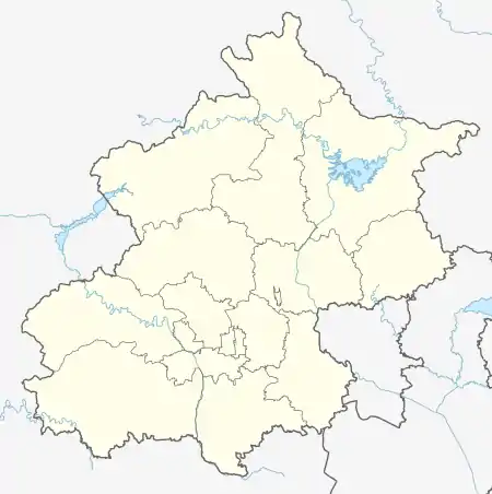
 Xinjiekou Subdistrict  Xinjiekou Subdistrict | |
| Coordinates: 39°56′30″N 116°21′53″E / 39.94167°N 116.36472°E | |
| Country | China |
| Municipality | Beijing |
| District | Xicheng |
| Area | |
| • Total | 3.7 km2 (1.4 sq mi) |
| Population (2020) | |
| • Total | 84,866 |
| • Density | 23,000/km2 (59,000/sq mi) |
| Time zone | UTC+8 (China Standard) |
| Postal code | 100035 |
| Area code | 010 |
Xinjiekou (Chinese: 新街口; pinyin: Xīnjiēkǒu) is a subdistrict of Xicheng District (西城区) of Beijing, China.[1] As of 2020, the subdistrict has a total population of 84,866.[2]
The subdistrict got its name from a section of road on the eastern portion of Xizhimennei Avenue, which used to be a river port but underwent land reclamation in 1438. The newly created land was settled, and recorded as Xinjiekou (Chinese: 新街口; lit. 'New Intersection') in 1593.[3]
History
| Time | Status |
|---|---|
| Qing dynasty | Part of the Zhenghong and Zhenghuang Banners |
| 1916 | Created as Right 4th Inner District |
| 1946 | Renamed 4th Inner District |
| 1949 | Renamed 4th District |
| 1952 | Renamed 4th Western District |
| 1958 | Reformed as Xinjiekou Subdistrict and Transferred under Xicheng District. |
| 2004 | Land west of Xinjiekoubei Avenue and former Fusuijing Subdistrict were incorporated |
Administrative Division
By 2021, It is divided into the following village-level divisions:[5]
| Administrative Division Code | Community Name in English | Community Name in Chinese |
|---|---|---|
| 110102003015 | Xili Second District | 西里二区 |
| 110102003020 | Xili First District | 西里一区 |
| 110102003025 | Xili Fourth District | 西里四区 |
| 110102003026 | Beicaochang | 北草厂 |
| 110102003028 | Xili Third District | 西里三区 |
| 110102003032 | Yutaoyuan | 玉桃园 |
| 110102003033 | Xisibei Toutiao | 西四北头条 |
| 110102003034 | Xisibei Santiao | 西四北三条 |
| 110102003035 | Xisibei Liutiao | 西四北六条 |
| 110102003036 | Yude | 育德 |
| 110102003037 | Qiangongyong | 前公用 |
| 110102003038 | Banbijie | 半壁街 |
| 110102003039 | Nanxiaojie | 南小街 |
| 110102003040 | Guanyingyuan | 冠英园 |
| 110102003042 | Dajue | 大觉 |
| 110102003043 | Fuguoli | 富国里 |
| 110102003045 | Anpingxiang | 安平巷 |
| 110102003046 | Guanyuan | 官园 |
| 110102003048 | Gongmenkou | 宫门口 |
| 110102003049 | Beishun | 北顺 |
| 110102003050 | Zhongzhi | 中直 |
Landmarks
See also
References
- ↑ "2020年统计用区划代码". www.stats.gov.cn. Retrieved 2021-04-25.
- ↑ Zhong guo tong ji nian jian = China statistical yearbook. 2020(zong di 39 qi) 2020(No. 39). Guo jia tong ji ju, 国家统计局. (Di 1 ban ed.). Beijing: Zhong guo tong ji chu ban she. 2020. ISBN 978-7-5037-9225-0. OCLC 1262741013.
{{cite book}}: CS1 maint: others (link) - ↑ Shen, Bang (1593). 《宛署杂记》 (in Chinese). p. 151.
- ↑ Zhong hua ren min gong he guo zheng qu da dian. Bei jing shi juan. Li li guo, Li wan jun, Wu shi min, 李立国., 李万钧., 吴世民. Bei jing: Zhong guo she hui chu ban she. 2013. ISBN 978-7-5087-4058-4. OCLC 910451741.
{{cite book}}: CS1 maint: others (link) - ↑ "2020年统计用区划代码和城乡划分代码". www.stats.gov.cn. Retrieved 2021-04-25.
External links
39°56′25″N 116°22′17″E / 39.9404°N 116.3713°E
This article is issued from Wikipedia. The text is licensed under Creative Commons - Attribution - Sharealike. Additional terms may apply for the media files.