Xixiang County
西乡县 Sisiang | |
|---|---|
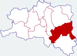
 Location in Hanzhong | |
.png.webp) Hanzhong in Shaanxi | |
| Coordinates (Xixiang railway station): 32°59′35″N 107°45′25″E / 32.993°N 107.757°E[1] | |
| Country | People's Republic of China |
| Province | Shaanxi |
| Prefecture-level city | Hanzhong |
| Area | |
| • Total | 3,240 km2 (1,250 sq mi) |
| Population (2018) | |
| • Total | 344,790 |
| • Density | 110/km2 (280/sq mi) |
| Time zone | UTC+8 (China standard time) |
| Postal code | 723500 |
| Licence plates | 陕F |
| Website | www |
Xixiang County (simplified Chinese: 西乡县; traditional Chinese: 西鄉縣; pinyin: Xīxiāng Xiàn) is a county under the administration of Hanzhong City, in the southwest of Shaanxi province, China,[2] bordering Sichuan province to the southwest. Its administrative center, Xixiang, formerly known as Hsihsiang, lies on the Muma River.[3] The county contains fourteen towns, eleven townships, and covers an area of 3,240 km2 (1,250 sq mi).
Administrative divisions
As 2019, Xixiang County is divided to 2 subdistricts and 15 towns.[4]
- Subdistricts
- Chengbei Subdistrict (城北街道)
- Chengnan Subdistrict (城南街道)
- Towns
|
|
Climate
| Climate data for Xixiang (1991–2020 normals) | |||||||||||||
|---|---|---|---|---|---|---|---|---|---|---|---|---|---|
| Month | Jan | Feb | Mar | Apr | May | Jun | Jul | Aug | Sep | Oct | Nov | Dec | Year |
| Mean daily maximum °C (°F) | 8.2 (46.8) |
11.6 (52.9) |
17.2 (63.0) |
23.0 (73.4) |
26.5 (79.7) |
29.7 (85.5) |
31.9 (89.4) |
31.5 (88.7) |
25.8 (78.4) |
19.9 (67.8) |
13.8 (56.8) |
8.8 (47.8) |
20.7 (69.2) |
| Daily mean °C (°F) | 2.7 (36.9) |
5.7 (42.3) |
10.4 (50.7) |
15.8 (60.4) |
19.9 (67.8) |
23.8 (74.8) |
26.2 (79.2) |
25.6 (78.1) |
20.7 (69.3) |
15.2 (59.4) |
9.1 (48.4) |
3.8 (38.8) |
14.9 (58.8) |
| Mean daily minimum °C (°F) | −1.0 (30.2) |
1.6 (34.9) |
5.6 (42.1) |
10.7 (51.3) |
15.1 (59.2) |
19.4 (66.9) |
22.1 (71.8) |
21.5 (70.7) |
17.5 (63.5) |
12.3 (54.1) |
6.2 (43.2) |
0.6 (33.1) |
11.0 (51.8) |
| Average precipitation mm (inches) | 5.0 (0.20) |
9.6 (0.38) |
26.6 (1.05) |
57.2 (2.25) |
99.2 (3.91) |
110.7 (4.36) |
151.1 (5.95) |
126.1 (4.96) |
133.1 (5.24) |
88.5 (3.48) |
34.6 (1.36) |
6.9 (0.27) |
848.6 (33.41) |
| Average precipitation days (≥ 0.1 mm) | 3.9 | 5.0 | 8.3 | 10.1 | 12.5 | 12.6 | 12.9 | 11.0 | 13.5 | 13.3 | 9.3 | 5.3 | 117.7 |
| Average snowy days | 3.2 | 1.6 | 0.4 | 0.1 | 0 | 0 | 0 | 0 | 0 | 0 | 0.3 | 1.1 | 6.7 |
| Average relative humidity (%) | 77 | 72 | 71 | 75 | 76 | 78 | 80 | 80 | 84 | 87 | 87 | 82 | 79 |
| Mean monthly sunshine hours | 77.4 | 82.1 | 124.4 | 152.7 | 160.5 | 157.3 | 183.4 | 185.0 | 106.9 | 85.0 | 68.2 | 73.0 | 1,455.9 |
| Percent possible sunshine | 24 | 26 | 33 | 39 | 37 | 37 | 42 | 45 | 29 | 24 | 22 | 24 | 32 |
| Source: China Meteorological Administration[5][6] | |||||||||||||
Economy
In the 19th century and early 20th century the area produced silk which was exported to Gansu.[3]
Transportation

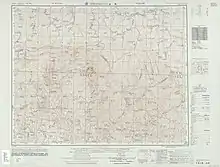
Map including Xixiang (labeled as HSI-HSIANG (SISIANG) 西鄉) (AMS, 1955)
Xixiang is served by the Yangpingguan–Ankang Railway. The Muma River supports small boat traffic.[3]
Notes
Wikimedia Commons has media related to Xixiang County.
Look up Xixiang in Wiktionary, the free dictionary.
- ↑ "Xixiang Railway Station Huochang". Google Maps. Retrieved 18 June 2018.
- ↑ Xixiang Xian (Approved) at GEOnet Names Server, United States National Geospatial-Intelligence Agency
- 1 2 3 Teichman, Eric (1921). Travels Of A Consular Officer In North-West China. Cambridge, England: Cambridge University Press. pp. 34–35. OCLC 257595152.
- ↑ "统计用区划代码 www.stats.gov.cn" (in Chinese). XZQH. Retrieved 2021-01-02.
- ↑ 中国气象数据网 – WeatherBk Data (in Simplified Chinese). China Meteorological Administration. Retrieved 24 September 2023.
- ↑ 中国气象数据网 (in Simplified Chinese). China Meteorological Administration. Retrieved 24 September 2023.
This article is issued from Wikipedia. The text is licensed under Creative Commons - Attribution - Sharealike. Additional terms may apply for the media files.