乌德纳达塔
乌德纳达塔(英文:Oodnadatta)為澳大利亚南澳大利亚州北部城镇,濒临尼尔斯河,曾經为澳大利亚中部的主要供应中心,隨著澳大利亚中央铁路西延后衰落,现時为运牛列车编组站。
| 乌德纳达塔 Oodnadatta | |
|---|---|
 The Pink Roadhouse at Oodnadatta | |
 乌德纳达塔 Oodnadatta | |
| 坐标: 27°32′53″S 135°26′44″E | |
| 国家 | |
| 一级行政区 | 南澳大利亚州 |
| 地方政府区域 | 偏遠地區社會發展託管地[1] |
| 地區 | 遠北[1] |
| 建立 | 1890年10月30日(市鎮) 2001年2月8日(地區)[2][1] |
| 海拔(火車站)[3] | 121 公尺(397 英尺) |
| 人口(2016年普查)[4] | |
| • 總計 | 204(與其他地區一同累計)人 |
| 时区 | ACST(UTC+9:30) |
| • 夏时制 | ACST(UTC+10:30) |
| 郵政編碼 | 5734[5] |
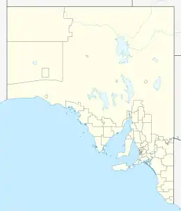
| 位置 | |
| 州選區 | 吉爾斯[6] |
| 聯邦選區 | 格雷[7] |
| 地區[1][5] 毗鄰地區[1] | |
參考注釋
- . Location SA Map Viewer. Government of South Australian Government. [13 May 2018].
- Bray, J.C. (PDF). The South Australian Government Gazette. South Australian Government: 1068. 30 October 1890 [13 May 2018]. (原始内容存档 (PDF)于2019-12-10).
- . Location SA Map Viewer. Government of South Australian Government. [13 May 2018]. (原始内容存档于2019-12-10).
- Australian Bureau of Statistics. . 2016 Census QuickStats. 27 June 2017 [29 May 2019].
- . Postcodes Australia. [13 May 2018]. (原始内容存档于2019-12-02).
- . Electoral Commission SA. [12 February 2018]. (原始内容存档于2021-01-08).
- (PDF). Australian Electoral Commission. [12 February 2018]. (原始内容存档 (PDF)于2015-03-26).
This article is issued from Wikipedia. The text is licensed under Creative Commons - Attribution - Sharealike. Additional terms may apply for the media files.