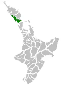
凯帕拉区
凯帕拉区(英語:)位于新西兰北部,为北地大区辖区,分为四个区。

Maungaturoto Markets are held on the 1st Friday of the month.

Photo taken from View Road, Maungaturoto
| 凯帕拉区 Kaipara District | |
|---|---|
| 二级行政区 | |
 位于達格維爾的凯帕拉区议会 | |
 | |
| 坐标:36°04′S 174°05′E | |
| 国家 | |
| 大区 | 北地大区 |
| 区 | 凯帕拉区议会 |
| 辖区 | Dargaville Otamatea Central West Coast |
| 政府所在地 | 達格維爾 |
| 政府 | |
| • 市长 | Jason Smith |
| • 副市长 | Peter Wethey |
| 面积 | |
| • Total | 3,117.09 平方公里(1,203.52 平方英里) |
| 人口( (2017年6月))[1] | |
| • Total | 22,500人 |
| • 密度 | 7.22人/平方公里(18.7人/平方英里) |
| 时区 | NZST(UTC+12) |
| • 夏时制 | NZDT(UTC+13) |
| 邮政编码 | Map of postcodes |
| 網站 | www |
凯帕拉区群山环抱,位于凯帕拉港北岸——一个面向塔斯曼海的大型港口。该港口由凯帕拉区议会、北方大区议会及奥克兰理事会共同管辖[2]。
凯帕拉区无主要的市区中心,但有许多的城镇及村庄。总人口22,500 (2017年6月)[1],其中大约有4,450人居住在凯帕拉区首府达格维尔。
参考资料
- . Statistics New Zealand. 2017-10-24 [2017-10-24]. For urban areas, . Statistics New Zealand. 2017-10-24 [2017-10-24].
- . The New Zealand Herald. 24 June 2011 [29 June 2011]. (原始内容存档于2016-03-04).
外部链接
| 维基共享资源上的相关多媒体资源:凯帕拉区 |
- Kaipara District Council website(页面存档备份,存于)
- Maungaturoto WebsiteArchive.is的存檔,存档日期2013-04-13
This article is issued from Wikipedia. The text is licensed under Creative Commons - Attribution - Sharealike. Additional terms may apply for the media files.