紅坊 (新南威爾斯州)
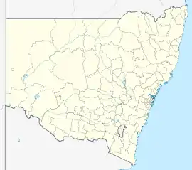
紅坊[1](英語:),又譯列墳[2][3]、雷德芬[4],是澳洲新南威爾斯州雪梨南部的一個市區,位於雪梨商業中心區以南3(1.9英里)處,是雪梨市地方政府行政區的一部分。士多啤梨山是與薩里山接壤的郊區。該地區已士紳化為高尚市區。[5]州政府亦曾對該地區大規模重建,以增加人口及降低該市區及鄰近的華打魯市區的清貧人口集中度。傳統上,此處為先住民聚居的地區。[6]
| 紅坊 Redfern | |
|---|---|
.jpg.webp) 紅坊公園 | |
 紅坊 | |
| 坐标:33°53′36″S 151°12′17″E | |
| 国家 | |
| 一级行政区 | 新南威爾士州 |
| 地方政府区域 | 雪梨市 |
| 面积 | |
| • 总计 | 1.2 平方公里(0.5 平方英里) |
| 海拔 | 37 公尺(121 英尺) |
| 郵政編碼 | 2016 |
| 位置 | 3(1.9英里) (距雪梨商業中心區以南) |
| 城市 | 悉尼 |
| 州選區 | 紐鎮 |
| 聯邦選區 | 雪梨 |
知名居民
參考
- . 人民網-澳大利亞頻道. 2018-05-17.
- . 廣益華報 The Chinese Australian Herald. 1905-08-12 [2024-03-19].
- . 民國報 Chinese Republic News. 1926-09-25 [2024-03-19].
- . 國立政治大學不動產研究中心. [2024-04-11] (中文).
- Moore, Matthew. . Sydney Morning Herald. 2011-04-30 [19 January 2014].
- . National Indigenous Australians Agency.
延伸閱讀
- Anne-Marie Whitaker. Pictorial History of South Sydney. Published by Kingsclear Books, Australia. 2002. (ISBN 0 908272 69 3)
外部連結
This article is issued from Wikipedia. The text is licensed under Creative Commons - Attribution - Sharealike. Additional terms may apply for the media files.