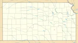
北布蘭奇 (堪薩斯州)
| 北布蘭奇 North Branch | |
|---|---|
| 非建制地區 | |
 北布蘭奇 | |
| 坐标:39°58′22″N 98°22′18″W | |
| 國家 | 美国 |
| 州 | 堪薩斯州 |
| 縣 | 朱厄爾縣 |
1870年代,於北布蘭奇的境內設立郵局,之後一直營運直到1959年結束[1]。
參考資料
- . Kansas Historical Society. [11 June 2014]. (原始内容存档于2015-12-24).
外部連結
- 美國地質調查局地名資訊系統:Northbranch
- Jewell County Map(页面存档备份,存于), KDOT
This article is issued from Wikipedia. The text is licensed under Creative Commons - Attribution - Sharealike. Additional terms may apply for the media files.