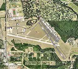
史汀森市立機場
史汀森市立機場(英語:,IATA代码:;ICAO代码:;FAA代码:),舊名為史汀森航空站,距離聖安東尼奧市中心的商業區6公里,為一座救援機場。
機場含有兩條跑道,海拔577英尺(176)海平面之上。
史汀森市立機場 Stinson Municipal Airport | |||||||||||||||
|---|---|---|---|---|---|---|---|---|---|---|---|---|---|---|---|
 2006 USGS Airphoto | |||||||||||||||
| 概览 | |||||||||||||||
| 机场类型 | 公眾/市立 | ||||||||||||||
| 所有者 | 聖安東尼奧市 | ||||||||||||||
| 營運者 | 聖安東尼奧航空局 | ||||||||||||||
| 服務城市 | 聖安東尼奧 | ||||||||||||||
| 地理位置 | 美國德克薩斯州聖安東尼奧 | ||||||||||||||
| 海拔高度 | 577英尺(175.9米) | ||||||||||||||
| 坐標 | 29°20′13.2270″N 98°28′16.1060″W | ||||||||||||||
| 網址 | www.sanantonio.gov/aviation/ | ||||||||||||||
| 地圖 | |||||||||||||||
 KSSF Location of Stinson Municipal Airport | |||||||||||||||
| 跑道 | |||||||||||||||
| |||||||||||||||
| 直升機停機坪 | |||||||||||||||
| |||||||||||||||
相關訊息
- Texas World War II Army Airfields
參考資料
- Thole, Lou (1999), Forgotten Fields of America : World War II Bases and Training, Then and Now - Vol. 2. Publisher: Pictorial Histories Pub, ISBN 1-57510-051-7
- https://web.archive.org/web/20120402180819/http://www.txwgcap.org/content/news_100805.htm
外部連結
- 史汀森市立機場官方網站(页面存档备份,存于)
- The Stinson Field Bulletin - Unofficial News / Information Site
- San Antonio Aviation - FBO / Charter Company(页面存档备份,存于)
- Pro Flite Aviation - Flight School(页面存档备份,存于)
- Sky Safety - Flight School(页面存档备份,存于)
- - Helicopter Tours and Flight School(页面存档备份,存于)
- Red Wing Aerial Photography - Aerial Photography Company(页面存档备份,存于)
- Aviation: From Sand Dunes to Sonic Booms, a National Park Service Discover Our Shared Heritage Travel Itinerary(页面存档备份,存于)
Template:Texas-airport-stub
This article is issued from Wikipedia. The text is licensed under Creative Commons - Attribution - Sharealike. Additional terms may apply for the media files.