地球半球
地球半球在地理學和地图学中指涉任何將地球分割成兩半的方式。經緯線最常被用來將地球劃成兩個半球[1]。
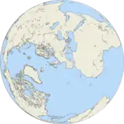
陸半球
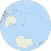
水半球
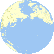
陸半球在上,水半球在下
陸半球在上,水半球在下
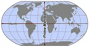
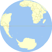
粗略將地球分成兩半球的地圖
參考文獻
- . 2011-03-22 [2022-04-29]. (原始内容存档于2019-07-09).
- Boggs, S. W. . Journal of Geography. 1945, 44 (9): 345–355. doi:10.1080/00221344508986498.
This article is issued from Wikipedia. The text is licensed under Creative Commons - Attribution - Sharealike. Additional terms may apply for the media files.