天文点
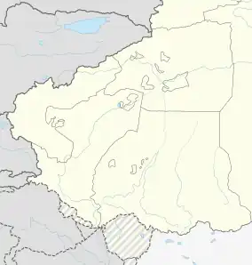
天文点是中华人民共和国設立在新疆维吾尔自治区和田地区和田县奇普恰普河流域達普桑盆地的一個边防哨所[3]。印度對該地區宣稱擁有主權。
| 天文点 | |
|---|---|
| 边防哨所 | |
 天文点 | |
| 坐标:35.331°N 78.179°E | |
| 海拔[1][2] | 5,171.2 公尺(16,965.9 英尺) |
| 天文点 | |||||||||
| 简化字 | |||||||||
|---|---|---|---|---|---|---|---|---|---|
| 字面意思 | astronomical point | ||||||||
| |||||||||
駐守在天文點的天文點邊防連組建于1959年[4]。在2013年斗拉特别奥里地事件發生後,中国人民解放军在该哨所建造了一个雷达站[5]。
天文點附近位於斗拉特别奥里地的印度軍營是中印邊境邊防會談會晤站之一[6]。
| 南疆军区在中印边境西段设置的边防连(哨所) | |||||||||||||||||||||||||||||||||
|---|---|---|---|---|---|---|---|---|---|---|---|---|---|---|---|---|---|---|---|---|---|---|---|---|---|---|---|---|---|---|---|---|---|
|
|||||||||||||||||||||||||||||||||
参考文献
- Baiping, Zhang. 57: 349–372. 2000. ISSN 0924-5499. doi:10.1007/978-94-010-0965-2_17.
Tianwendian (5171.2 m)
- . 新闻联播. CCTV-13. 2013-12-22 [30 December 2019]. (原始内容存档于2019-12-30).
海拔5170米 天文点官兵扎根奉献
- . 和田县政府门户网站. 29 April 2019 [23 December 2019]. (原始内容存档于2020-06-25) (中文(简体)).
- 陈杰. . Xinhua News. 2013-12-19 [14 December 2019]. (原始内容存档于2019-12-14) (中文).
天文点边防连组建于1959年。
- Bhat, Vinayak. . ThePrint. 25 August 2017 [5 January 2020]. (原始内容存档于2020-06-27).
The Depsang area came into the limelight during 2013 Daulat Beg Oldie incident when the PLA pitched tents and constructed watchtowers much higher than required. At that time, China had also constructed a huge radar on a hillock north of their post called Tianwendian.
- . News18. [2017-09-14]. (原始内容存档于2019-12-14).
参见
| 喀喇昆仑走廊和阿克赛钦的相关位置图 |
|---|
 3 7 10 12 16 19 22 24 31 32 34 36 37 38 51 57 喀喇昆仑走廊和阿克赛钦的相关位置图 图例:
|
