奧利弗縣 (北達科他州)
奧利弗县(英語:)是位於美國北達科他州西南部的一個縣。面積1,894平方公里。根據美國2000年人口普查估計,共有人口2,065人。縣治中心。
| 奧利弗縣 Oliver County | |
|---|---|
| 县 | |
.jpg.webp) 流经克罗斯牧场州立公园的密苏里河 | |
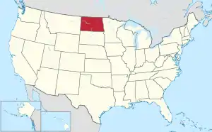
 奧利弗縣于北達科他州中的位置 | |
 北達科他州于美国的位置 | |
| 坐标: 47°07′N 101°21′W | |
| 国家 | |
| 州 | |
| 设立日期 | 1885年4月14日(设立) 1885年5月18日(组建) |
| 語源 | 哈里·S·奥利弗 |
| 县治 | 中心 |
| 最大城市 | 中心 |
| 面积 | |
| • 总计 | 731 平方英里(2,000 平方公里) |
| • 陸地 | 723 平方英里(2,000 平方公里) |
| • 水域 | 8.7 平方英里(20 平方公里) 1.2% |
| 人口(2020年) | |
| • 總計 | 1,877人 |
| • 估计(2021年) | 1,873 |
| 时区 | 中部时区(UTC−6) |
| • 夏时制 | 中部时区(UTC−5) |
| 包含的国会选区 | 單一國會選區 |
奧利弗縣成立於1885年3月12日,縣政府成立於5月18日。縣名是紀念達科他準州議員、州議員哈利·S奧利弗[1]。
参考文献
- Kane, J. N. and C. C. Aiken. The American Counties: Origins of County Names Dates of Creation and Population Data 1950-2000. Lanham, MD.: Scarecrow Press, 2005.
This article is issued from Wikipedia. The text is licensed under Creative Commons - Attribution - Sharealike. Additional terms may apply for the media files.