屈利嶺
屈利嶺(英語:Walkley Heights)是南澳州阿德萊德梳士巴利市及阿德萊德港恩埠市的一個地域行政分區。
| 屈利嶺 | |
|---|---|
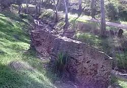
 屈利嶺自然保護區 | |
 屈利嶺 | |
| 坐标:34°50′20″S 138°38′17″E | |
| 国家 | |
| 一级行政区 | 南澳大利亚州 |
| 地方政府区域 | |
| 建立 | 1995 |
| 人口(2006年普查)[1] | |
| • 總計 | 3,224人 |
| 郵政編碼 | 5098 |
| 城市 | 阿德萊德 |
屈利嶺前身包括油泰來勞工監獄的監獄農場。餘下佔地五十五公頃的土地,原是由R. M. Williams所擁有;其後被前州長卑利霍(Sir Thomas Playford)徵收為政府用地。[2] 屈利嶺以南澳州拓荒者屈利(John Walkley)而命名。[3]
2001年,屈利嶺人口只有713人。[4]2006年,人口增幅至3,224人。
在磡士德大道(Homestead Avenue)是屈利嶺的市中心,尾段有一個小型商場、Foodland超級市場、比薩店、麵包店、救世軍義賣店、美容院、診所、托兒所和幼稚園。
環境

屈利嶺的房屋

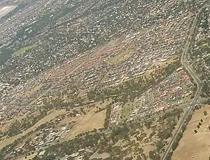
俯瞰屈利嶺
屈利嶺位於種滿赤桉的乾河狀形公園的另一邊,附近的種植園仍然保留一間古老的飼養人(Stockman)的小屋。狀形公園是屈利嶺的自然保護區,進行城市森林多樣性計劃(Urban Forest Biodiversity Programme),保育等樹林。[5]
參見
- 阿德萊德地域行政區分列表
參考文獻
- 澳大利亚统计局. . 2006 Census QuickStats. 2007-10-25 [25 October 2007].
- Postcards – Dry Creek – Linear Park 的存檔,存档日期2006-08-21.
- www.placenames.sa.gov.au Government of South Australia, Land Services Group (页面存档备份,存于)
- Australian Bureau of Statistics 2001 Census of Population and Housing
- Urban Forest Biodiversity Program, press release from www.urbanforest.on.net (页面存档备份,存于)
This article is issued from Wikipedia. The text is licensed under Creative Commons - Attribution - Sharealike. Additional terms may apply for the media files.