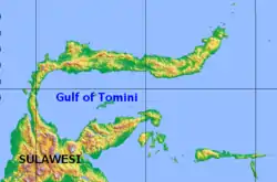
托米尼灣
范围
国际海道测量组织(IHO)定义托米尼湾是东印度群岛(East Indian Archipelago)的一部分[1],托米尼湾被定义为“摩鹿加海西界”以西的水域[2]。其范围为Pasir Pandjang(0°39′S 123°25′E)到对面海岸Tombalilatoe(123° 21′ E)的界线以西水域。
资料来源
引用
- IHO (1953),§48.
- IHO (1953),§48 (d).
This article is issued from Wikipedia. The text is licensed under Creative Commons - Attribution - Sharealike. Additional terms may apply for the media files.
