提魯瓦南塔普拉姆縣
提魯瓦南塔普拉姆縣是印度喀拉拉邦最南的一個縣,面積2,192平方公里,2001年人口3,307,284,識字率為92.66%,人口密度每平方公里1,509人。2011年人口3,301,427,識字率為93.02%。[1]
| 提魯瓦南塔普拉姆县 തിരുവനന്തപുരം ജില്ല | |
|---|---|
| 喀拉拉邦的县 | |
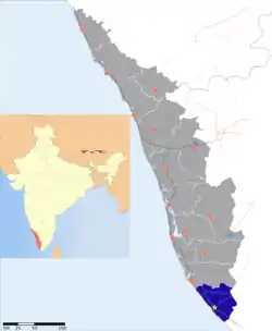 提魯瓦南塔普拉姆县在喀拉拉邦的位置 | |
| 坐标:8°29′N 76°56′E | |
| 国家 | |
| 邦 | 喀拉拉邦 |
| 行政中心 | 提魯瓦南塔普拉姆 |
| 乡 | 1. Thiruvananthapuram, 2. Chirayinkeezhu, 3. Neyyattinkara, 4. Nedumangadu |
| 政府 | |
| • 人民院选区 | 1. Attingal, 2. Thiruvananthapuram |
| • 邦议会席位 | 14 |
| 面积 | |
| • 总计 | 2,192 平方公里(846 平方英里) |
| 人口(2011年) | |
| • 总计 | 3,301,427人 |
| • 密度 | 1,506人/平方公里(3,901人/平方英里) |
| 人口统计 | |
| • 识字率 | 93.02%[1] |
| 时区 | IST(UTC+5:30) |
| 車輛號牌 | KL-01, KL-15, KL-16, KL-19, KL-20, KL-21, KL-22 |
| 主要高速公路 | NH-47 |
| 坐標 | 8.48°N 76.94°E |
| 年平均降水量 | 1,700 mm |
| 網站 | 官方网站 |
參考文獻
- . [2015-02-11]. (原始内容存档于2011-06-11).
外部連結
- Official District website
- (页面存档备份,存于) Best Places in Thiruvananthapuram
- Government of Kerala Website on Thiruvananthapuram District
This article is issued from Wikipedia. The text is licensed under Creative Commons - Attribution - Sharealike. Additional terms may apply for the media files.