日梅勒
日梅勒(法語:)是瑞士联邦西部法语区的沃州下设的一个镇。在行政上属于莫尔日区管辖。日梅勒的总面积为18.89平方公里。截至2010年底,总人口为1,767。[1]
| 日梅勒 | ||
|---|---|---|
 | ||
| ||
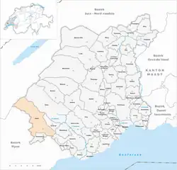 | ||
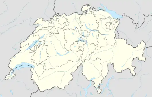 日梅勒 日梅勒在瑞士的位置 | ||
| 坐标:46°31′N 6°18′E | ||
| 國家 | ||
| 州 | 沃州 | |
| 区 | 莫尔日区 | |
| 语言 | 法语 | |
| 政府 | ||
| • 市長 | Norbert Reymond | |
| 面积 | ||
| • 总计 | 0 平方公里(0 平方英里) | |
| 海拔 | 723 公尺(2,372 英尺) | |
| 人口 | ||
| • 總計 | 1,767人 | |
| 时区 | CET(UTC+1) | |
| • 夏时制 | CEST(UTC+2) | |
| 郵政編碼 | 1188 | |
| SFOS號碼 | 5428 | |
| 網站 | www | |

历史
2006年8月31日前,日梅勒属于奥伯讷区。此后,奥伯讷区解散,日梅勒归入莫尔日区。[2]
参考资料
- (法文)résidante permanente (total) selon les districts et les communes (页面存档备份,存于) 瑞士联邦统计局
- Nomenklaturen – Amtliches Gemeindeverzeichnis der Schweiz 的存檔,存档日期2015-11-13. (德文) accessed 4 April 2011
- Swiss Federal Statistical Office-Land Use Statistics (页面存档备份,存于) 2009 data (德文) accessed 25 March 2010
This article is issued from Wikipedia. The text is licensed under Creative Commons - Attribution - Sharealike. Additional terms may apply for the media files.