東南角 (塔斯馬尼亞島)
东南角(英語:)是澳大利亚塔斯马尼亚島最南端的海角,[1]屬於世界遗产塔斯马尼亚荒野的一部分,位於塔斯马尼亚州霍巴特西南约94公里(58英里)。该海角也是塔斯马尼亚南部海岸线的一个参考点。[2] 附近有大量船隻经过,许多船只在海角附近失事或搁浅。[3]
| 東南角 South East Cape | |||||||||||||||
|---|---|---|---|---|---|---|---|---|---|---|---|---|---|---|---|
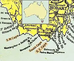
 1916年的塔斯马尼亚岛南海岸地图,圖中標示東南角 | |||||||||||||||
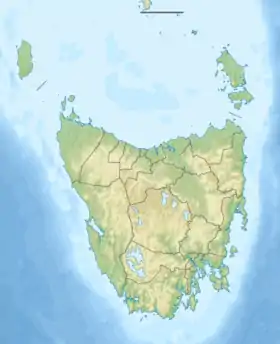
 塔斯馬尼亞州東南角 | |||||||||||||||
| 位置 | 塔斯马尼亚岛南海岸 | ||||||||||||||
| 座標 | 43°38′37″S 146°49′39″E | ||||||||||||||
| |||||||||||||||
参考资料
- . The Mercury (Hobart) (Hobart, Tasmania). 18 May 1945: 7 [29 June 2015]. (原始内容存档于2020-08-24) –National Library of Australia.
- Nash, Michael; Tasmania. Dept. of Lands, Parks and Wildlife, , Department of Lands, Parks and Wildlife, 1988, ISBN 978-0-7246-2113-2
- Tasmania. Navigation and Survey Authority, , Navigation and Survey Authority of Tasmania, 1995 [29 June 2015], (原始内容存档于2020-08-24)
外部链接
- Continental Extremities of Australia
- Picture of South East Cape
- Map of the area with South East Cape on the right edge, South Cape, South West Cape, the Maatsuyker Islands with De Witt Island, The Sisters and Maatsuyker Island (页面存档备份,存于)
- Another map of the area between South East Cape and South West Cape and the Maatsuyker Islands (页面存档备份,存于)
This article is issued from Wikipedia. The text is licensed under Creative Commons - Attribution - Sharealike. Additional terms may apply for the media files.