格拉尼特峰
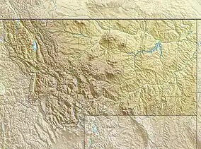
格拉尼特峰(英語:),海拔12,807英尺(3,904),[1]是美国蒙大拿州的自然最高点,同时也是美国国内的第十高峰。[3]它位于帕克縣阿布萨罗卡-熊牙荒原内,临近斯蒂爾沃特縣、卡本縣的县界处,怀俄明州州界线10英里(16)、哥伦布以西南45英里(72)处。
| 格拉尼特峰 | |
|---|---|
Granite Peak | |
 | |
| 最高点 | |
| 海拔 | 12,807英尺(3,904) NAVD 88[1] |
| 地形突起度 | 4,759英尺(1,451) [2] |
| 列表 | 美国各州最高点第10名 |
| 45°09′48″N 109°48′27″W [1] | |
| 地理 | |
| 山脈 | 熊牙山脉 |
| 地形圖 | 美國地質調查局格拉尼特峰 |
| 攀山 | |
| 首次登頂 | 1923年,Elers Koch |
| 最简路线 | Southwest Couloir (class 3 scramble) |
参考资料
- . NGS data sheet. 美国测地局.
- . Peakbagger.com. [2008-12-13].
- . United States Geological Survey. 2005-04-29 [2009-03-29]. (原始内容存档于2008-01-16).
This article is issued from Wikipedia. The text is licensed under Creative Commons - Attribution - Sharealike. Additional terms may apply for the media files.
