比特島
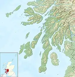
比特島是蘇格蘭的島嶼,位於阿倫島以北大西洋海域,由阿蓋爾-比特負責管轄,屬於英倫諸島的一部分,長24公里、寬8公里,面積122.17平方公里,最高點海拔高度278米,2001年人口7,228。比特侯爵家族时代在此居住。
| 盖尔语 | |
|---|---|
| 古諾斯語 | |
| 位置 | |
 Isle of Bute Isle of Bute shown within Argyll and Bute | |
| 英國格網 | 25 |
| 经纬度 | 55°49′26″N 05°06′39″W |
| 自然地理 | |
| 所屬島群 | 克莱德湾 |
| 面积 | 12,217 ha(471⁄8 sq mi)[2] |
| 面积排名 | 13 [3] |
| 最高点 | Windy Hill, 278米(912英尺) |
| 行政机关 | |
| 主权国 | 英国 |
| 构成国 | 苏格兰 |
| 区域议会 | 阿盖尔和比特 |
| 人口統計 | |
| 人口 | 6,498[4] |
| 人口排名 | 5[4] [3] |
| 人口密度 | 53.19/km2(137.8/sq mi)[2][4] |
| 最大居住区 | 罗撒西 |
| 注释 | [5] |
历史

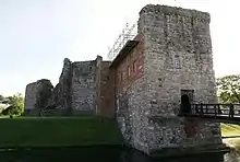
罗撒西城堡
这座岛屿在史前便有人类居住,岛上发现了公元前2000年女王(Queen of the Inch)所用的项链[6]。5世纪时,爱尔兰圣人马卡(Maccai)曾在此传道[7],后为达尔里阿达王国和群岛王国先后统治,12世纪时被大卫一世赐给萨默莱德。12和13世纪之交,它开始由苏格兰王室总务官统治[8]。
参考文献
- Anderson, Joseph (编), , 由Hjaltalin, Jón A.; Goudie, Gilbert翻译, translated for James Thin, Edinburgh: Mercat Press, 1893 (1990), ISBN 978-0-901824-25-7
- Haswell-Smith (2004) p. 23.
- Area and population ranks: there are 约300 islands over 20 ha in extent and 93 permanently inhabited islands were listed in the 2011 census.
- 蘇格蘭國家紀錄(2013年8月15日)(pdf) Statistical Bulletin: 2011 Census: First Results on Population and Household Estimates for Scotland - Release 1C (Part Two). “附錄2:蘇格蘭有人居住的島嶼的人口和家庭”。 檢索於2013年8月17日。
- Haswell-Smith (2004) pp. 23–28
- "The Queen of the Inch Necklace and Facial reconstruction" 的存檔,存档日期19 June 2010.. Bute Museum. Retrieved 5 September 2010.
- O'Hanlon 1875,第124頁.
- Forte, Angelo; Oram, Richard D.; Pedersen, Frederik, , Cambridge University Press: 241–248, 2005, ISBN 978-0-521-82992-2
参考书目
 Hedderwick, Robert, , Baynes, T.S. (编), 4 9th, New York: Charles Scribner's Sons: 579–581, 1878
 Chisholm, Hugh (编). . 4 (第11版). London: Cambridge University Press: 878–879. 1911.
- Haswell-Smith, Hamish. . Edinburgh: Canongate. 2004. ISBN 978-1-84195-454-7.
- Hewison, James King (1893) The Isle of Bute in the Olden Time. Edinburgh. William Blackwood and Sons. Retrieved 18 Sep 2011.
- Jennings, Andrew and Kruse, Arne (2009) "From Dál Riata to the Gall-Ghàidheil (页面存档备份,存于)". Viking and Medieval Scandinavia. 5. Brepols.
- Iain Mac an Tàilleir. (PDF). Pàrlamaid na h-Alba. 2003 [23 July 2010]. (原始内容 (PDF)存档于23 September 2011).
- Template:Monro
- O'Hanlon, John, 4, Dublin: James Duffy, 1875 [2021-08-23], (原始内容存档于2022-02-24)
- Watson, W. J. (1994) [1926]. The Celtic Place-Names of Scotland. Edinburgh: Birlinn. ISBN 1-84158-323-5.
外部連結
- Bute's historic sites Archive.is的存檔,存档日期2012-12-23 at Canmore
- Port Bannatyne Marina and Boatyard (页面存档备份,存于)
- Port Bannatyne to Glasgow Airlink (页面存档备份,存于)
- Bute Sons & Daughters project (页面存档备份,存于)
- Bute Gateway (local facilities)
- Isle of Bute V-Day website (dedicated to the Island's WWII contribution)
- The Buteman (local newspaper) (页面存档备份,存于)
- Bute FM (Community Radio Station) Archive.is的存檔,存档日期2012-12-24
- ButeWiki (页面存档备份,存于)
- Port Bannatyne Petanque Club (页面存档备份,存于)
- Sailing reviews and news (页面存档备份,存于)
- Bute in Pictures, BBC News (页面存档备份,存于)
- Bute on BBC Island Blogging (页面存档备份,存于)
This article is issued from Wikipedia. The text is licensed under Creative Commons - Attribution - Sharealike. Additional terms may apply for the media files.