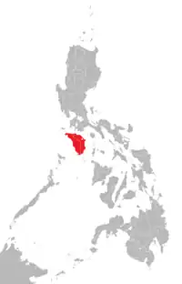
民都洛
地形
民都洛岛长约160公里,南北宽84公里,岛上最高的山有2500多公尺,大部分的地区还是相当原始,路面颠簸不平是稀鬆平常的事,岛上的原住民更为原始。
行政
民都洛岛上较有开发的地方是东民都洛岛的加萊拉港(Puerto Galera)一带,这裡有相当多的潜水点及饭店,对马尼拉人来说,这裡方便易往,从马尼拉邻近的港口搭船只需一个多小时。民都洛岛包含東民都洛省和西民都洛省。
東民都洛省的首府是卡拉潘,观光客聚齐的地方以格雷拉港为主,潜水、浮潜以及水上活动很多,沙滩包含小拉古娜海灘(Little Lalaguna Beach)、大拉古娜海灘(Big Lalaguna Beach),而沙班海灘(Sabang Beach)是其中最热闹的区域之一,有很多旅馆、pub。
文獻
- C.Michael Hogan. 2011. Sulu Sea. Encyclopedia of Earth. Eds. P.Saundry & C.J.Cleveland. Washington DC (页面存档备份,存于)
連接
| 维基共享资源上的相关多媒体资源:民都洛 |
- "Map of Mindoro" (页面存档备份,存于) showing towns and major mountain tops
- Mindorenyos - Connecting Mindoro People
- Online Community for Mindorenyos
This article is issued from Wikipedia. The text is licensed under Creative Commons - Attribution - Sharealike. Additional terms may apply for the media files.
