沃什特瑙縣
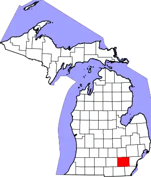
沃什特瑙县(英語:)是美国密西根下半島東南部的一個縣。面積1,871平方公里。根據2020年美國人口普查,共有人口372,258人[3]。縣治安娜堡。該縣成立於1822年9月10日,縣政府成立於1826年11月20日;縣名來自奧傑布瓦語中對格蘭德河的稱呼,意思可能是「遠方的河流」。[4]
| 沃什特瑙縣 Washtenaw County | |
|---|---|
| 县 | |
.jpg.webp) 沃什特瑙縣法院 | |
 沃什特瑙縣于密西根州中的位置 | |
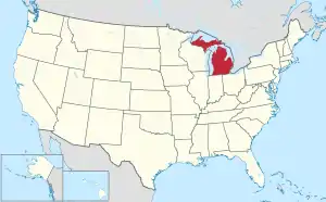
 密西根州于美国的位置 | |
| 坐标: 42°15′N 83°50′W | |
| 国家 | |
| 州 | |
| 设立日期 | 1826年[1][2] |
| 語源 | O-wash-ta-nong,奥吉布瓦语对格兰德河的称呼 |
| 县治 | 安娜堡 |
| 最大城市 | 安娜堡 |
| 面积 | |
| • 总计 | 722 平方英里(2,000 平方公里) |
| • 陸地 | 706 平方英里(2,000 平方公里) |
| • 水域 | 16 平方英里(40 平方公里) 2.3% |
| 人口(2020年) | |
| • 總計 | 372,258人 |
| • 密度 | 527人/平方英里(203人/平方公里) |
| 时区 | 东部时区(UTC−5) |
| • 夏时制 | 东部时区(UTC−4) |
| 包含的国会选区 | 第6選區 |
| 網站 | www |
参考文献
- . Clarke Historical Library, Central Michigan University. [January 23, 2013]. (原始内容存档于October 6, 2014).
- . ewashtenaw.org. [June 16, 2006]. (原始内容存档于October 28, 2012).
- . US Census Bureau. [2013-08-29]. (原始内容存档于2011-06-06).
- Kane, J. N. and C. C. Aiken. The American Counties: Origins of County Names Dates of Creation and Population Data 1950-2000. Lanham, MD.: Scarecrow Press, 2005.
This article is issued from Wikipedia. The text is licensed under Creative Commons - Attribution - Sharealike. Additional terms may apply for the media files.