波里塔迪斯湖
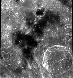
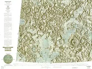
仁慈湖又译作波里塔迪斯湖(拉丁語:)是月球正面东部的一座小月海,长约130公里、宽60公里。该湖的名字首次出现在1974年美国军事测绘局为美国宇航局测绘的月图中[1],1976年被为国际天文学联合会批准采纳[2][3]。
| 仁慈湖 | |
|---|---|
 | |
| 纬度 | 23.2°N |
| 经度 | 47.3°E |
| 直径 | 92 公里 |
| 命名来源 | 仁慈湖 |
.png.webp)
幸福湖所处月球正面的位置
描述
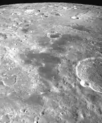
仁慈湖是一个凹凸不平且边界不规则的玄武熔岩区,从东北向西南延伸约130公里,宽度50-60公里,中间横亘着一座小山丘。月湖北岸坐落着直径5公里,已被熔岩填塞的"马克罗比乌斯 W"卫星坑,这是截止2015年该月湖中唯一已命名的陨石坑[4]。
该湖东南边缘是直径65公里的马克罗比乌斯环形山,周围散布着它的众多卫星坑;西南岸附近是直径15公里的埃斯克朗贡陨石坑;三座明亮撞击坑:希尔陨石坑、卡迈克尔陨石坑和特拉勒斯陨石坑分别位于它的西南和东北。
月湖中可看到年轻撞击坑-特拉勒斯陨石坑和普罗克洛斯陨石坑明亮的射纹线;在毗邻月湖南端的一处小月海区,一座直径约1公里的撞击坑环绕着一圈明亮细长的溅射环。
参考资料
- . Sheet LTO-43C1: Hill ed. 1. Prepared and published by the Defence Mapping Agency Topographic Center, Washington, D.C. May 1974 [2016-04-18]. (原始内容存档于2016-03-06).
- . Gazetteer of Planetary Nomenclature. International Astronomical Union (IAU) Working Group for Planetary System Nomenclature (WGPSN). [2015-06-17]. (原始内容存档于2012-07-03).
- E. Müller & A. Jappel. . D. Reidel Publishing Company. 1977: 340. ISBN 90-277-0836-3. (Excerpts (页面存档备份,存于);)
- According to nomenclature guide МАС (页面存档备份,存于) (Map (页面存档备份,存于))
- According to the laser altimeter on the satellite Lunar Reconnaissance Orbiter, obtained through the program JMARS (页面存档备份,存于)
This article is issued from Wikipedia. The text is licensed under Creative Commons - Attribution - Sharealike. Additional terms may apply for the media files.


