當河 (安大略省)
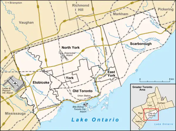
當河[1](英語:)是加拿大安大略省南部的一條河流,於多倫多港注入安大略湖。它的河口位於上加拿大約克鎮街道網格的東邊,該城鎮後來演變為安大略省多倫多市。當河是多倫多的主要水道之一(同漢伯河及紅河齊名),其源頭位於橡樹嶺冰磧。
| 當河 Don River | |
|---|---|
 當河及當河谷園林公路 | |
 當河河口在多倫多的位置 | |
| 國家 | |
| 省份 | |
| 城市 | |
| 流域 | |
| 水系 | 安大略湖流域 |
| 流向 | 安大略湖→聖羅倫斯河→聖羅倫斯灣 |
| 源頭 | 橡樹嶺冰磧 |
| - 位置 | 加拿大安大略省 |
| - 坐標 | 43°59′20″N 79°23′57″W |
| 河口 | 基廷運河 |
- 位置 | 加拿大安大略省 |
- 座標 | 43°39′4″N 79°20′51″W |
- 海拔 | 75米(246英尺) |
| 面積 | 360 km2(140 sq mi) |
| 本貌 | |
| 長度 | 38 km(24 mi) |
| 流量 |
|
| 特徵 | |
| 支流 |
|
當河由東西兩條支流組成,在安大略湖以北約7(4英里)處匯合,向南流入湖中。匯合處以下的區域稱為「下當河」,匯合處以上的區域稱為「上當河」。當河在匯合處還匯入了第三條主要支流——泰勒-梅西溪。多倫多及地區保護局(TRCA)負責管理這條河流及其周圍的流域。
參考
腳註
- 明報加東版. . www.mingpaocanada.com. [2023-08-05].
- ODPD 1950,第Part IV, 1頁.
書目
- Leigh Bonnell, Jennifer. . thesis, University of Toronto. 2010.
- Brown, Ron. . Polar Bear Press. 1997. ISBN 1896757022.
- Ontario Department of Planning and Development. . Toronto, Ontario. 1950.
- Sauriol, Charles (1981) Remembering the Don: A Rare Record of Earlier Times Within the Don River Valley. Consolidated Amethyst Communications. ISBN 0-920474-22-5ISBN 0-920474-22-5
- Sauriol, Charles (1984) Tales of the Don. Natural Heritage/Natural History. ISBN 0-920474-30-6ISBN 0-920474-30-6
- Sauriol, Charles. . Hemlock Press. 1992. ISBN 0-929066-10-3.
- Scadding, Henry. . Adam, Stevenson & Co. 1873.
外部連結
- Don River Watershed (页面存档备份,存于) at the Toronto and Region Conservation Authority
- Environment Canada (Toronto Remedial Action Plan) Great Lakes Portrait: Bringing back the Don River
- Task Force to Bring back the Don
- Don Watershed Regeneration
- Lower Don River (页面存档备份,存于) at Lost River Walks
- Friends of the Don East (页面存档备份,存于)
- Todmorden Mills Wildflower Preserve (页面存档备份,存于) in the Don River Valley
This article is issued from Wikipedia. The text is licensed under Creative Commons - Attribution - Sharealike. Additional terms may apply for the media files.