皮里地
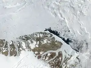
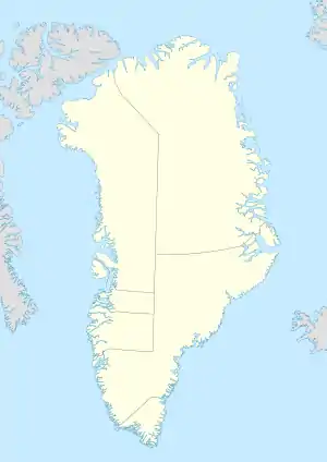
皮里地(Peary Land)格陵兰东北部的一个半岛,西滨维多利亚峡湾,南面与东南面为独立峡湾,北临大西洋,半岛北端的莫里斯·杰塞普角是格陵兰本岛的最北端。[1]
| 皮里地 | |
|---|---|
 皮里地卫星影像 | |
 皮里地 | |
| 地理 | |
| 位置 | 格陵兰东北 |
| 坐标 | 82°38′N 32°30′W |
| 鄰近水域 | 维多利亚峡湾 |
| 长度 | 360千米(224英里) |
| 宽度 | 200千米(120英里) |
| 最高海拔 | 1,929米(6329英尺) |
| 最高點 | 海尔维第·廷德 |
| 管轄 | |
| 人口统计 | |
| 人口 | 无人居住 |
皮里地是格陵兰岛最大的无常年冰雪覆盖的地区,地形多为山地,海拔可达1950米。海岸线多峡湾。该地区没有人类居住,有成群的麝牛栖息于此。1892年、1895年和1900年,美国北极探险家罗伯特·皮里对其进行了部分考察探索。[2]
参考文献
- . Mapcarta. [5 May 2016]. (原始内容存档于2022-03-18).
- Britannica, The Editors of Encyclopaedia. "Peary Land". Encyclopedia Britannica, 20 Jul. 1998, https://www.britannica.com/place/Peary-Land (页面存档备份,存于). Accessed 19 March 2022.
This article is issued from Wikipedia. The text is licensed under Creative Commons - Attribution - Sharealike. Additional terms may apply for the media files.