維多利亞州地方政府區域
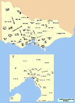
地方政府區域(Local Government Area,简称LGA)是澳大利亚的二级行政区,是地方政府的辖区。维多利亚州作为澳大利亚人口第二大的联邦州,境内共有79个地方政府区域,外加10个受州政府直辖的“未划分区域”。

由於澳大利亞的政治度仿英國西敏制(The Westminster System of government)而採議會,自中央以下至州,分为市(city)、郡(shire)、區(district)及自治市/镇(municipality/borough),各行政部門的首長皆由立法部門的成員擔任,且須由議會或下議院(若有)內的「多數黨」組成政府;例如:聯邦下議員(Member of Lower House)組成聯邦政府(Federal Government)、州議員組成州政府(state government)、市議員組成理事会形式的市政府(city council)等。因此淵源,澳大利亞英語裡的地方「議會」(council)之含意[1]等同於地方政府(local government)。
沿革
墨爾本市在維州發展史上向來執牛耳之勢,百年來都是帶動州內發展的政經中心,所以一個功能完善、產業集中、能充分發揮土地利用率的墨爾本中央商務區(CBD)對於維州至為關鍵。由於這項討論牽涉到墨爾本的市政區應該如何「重新劃分」方能提高行政效率與健全財政的問題,因此維多利亞州的地方事務改革乃以州政府自1980年12月起,對於「如何提高政府效率」的討論為起點;首先於是年派出3位委員以決議修法劃界、調整市政體、定義政府功能及具體行政責任等相關事宜。
1982年,新上任的工黨政府撤銷了負責地方事務改革的委員會、設立了6個墨爾本市的選區(wards),並於當年12月進行了選區劃定之後的首屆市議員選舉;3年後再加進了1個新選區。
1989年,州議會通過了《地方自治法》(Local Government Act),允了府城墨爾本的改,使墨城原本所轄的各區,整併格為地方政府的「市」與郡;目的是使各地方政府成立後,可拉近官民之間的層級,鼓勵雙方針對社區發展而勤於溝通,並從中尋求可商議的協調模式,使一切資源得以更具效率地被使用、政府官員可更負責任地因應鄰所需解決的公共事務[2]。另在權力與責任加重的前提下,各市與郡的政務官除了須對所屬的議會進行施政報告和接受咨詢,亦須對州議會負責;報告和咨詢內容包括市政規劃、道路興建和修整、廢棄物處理等主要市政[3]。
1993年,《墨爾本市自治法》(City of Melbourne Act)具體劃定了市區的界線,並且根據新的市政轄境,再次重新調整了選區成4個[4]。
2001年,州政府將上述墨爾本市內的4個選區增加至7個以後,進一步開放了市民直選市長。在此之前,州府認為墨爾本市地位關鍵,市長一職應由市議員之中推選出1位人選來擔任[5]。
2007年7月2日,州政府將原本所轄的港區-Docklands也歸入墨爾本市,使墨城的市政轄境擴充近一倍。
类型
維多利亞州現轄79個地方政府,依次分四類:
- 市議會:32個原屬墨爾本市政區或衛星城市的都會型城市(metropolitan City Council)
- 乡郊市議會:7個農村型城市/鄉鎮(rural City Council)
- 郡議會:39個位於距離都會區比較遠、幅員遼闊的鄉鎮(Shire Council)
- 自治鎮議會:1個位於墨爾本地區最外圍的小鎮(Borough Council)
列表
墨尔本大都市(Greater Melbourne)
| 地方政府区域 | 政府所在 | 地区 | 成立日期 | 面积 (km2) | 人口 (2018)[6][7] | 人口密度 | Councillors (2012) | 注 | 地图 |
|---|---|---|---|---|---|---|---|---|---|
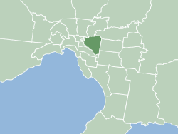
| City of·Melbourne | Melbourne | 内郊 | 1842年8月12日 | 37 | 169,961 | 11,897 | 11 |  | |
| City of·Port Phillip | St Kilda | 内郊 | 1994年6月22日 | 21 | 113,200 | 13,961 | 7 | Merger of St Kilda, South Melbourne and Port Melbourne |  |
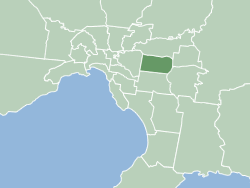
| City of·Stonnington | Malvern | 内郊 | 1994年6月22日 | 26 | 116,207 | 11,576 | 9 | Merger of Malvern and Prahran |  |
| City of·Yarra | Richmond | 内郊 | 1994年6月22日 | 20 | 98,521 | 12,758 | 9 | Merger of Richmond, Collingwood, Fitzroy, Northcote and parts of Melbourne |  |
| City of·Banyule | Greensborough | 外郊 | 1994年12月15日 | 63 | 130,237 | 5,354 | 7 | Merger of Heidelberg and parts of Diamond Valley and Eltham |  |
| City of·Bayside | Sandringham | 外郊 | 1994年12月15日 | 37 | 105,718 | 7,400 | 7 | Merger of Brighton and Sandringham and parts of Mordialloc and Moorabbin |  |
| City of·Boroondara | Camberwell | 外郊 | 1994年6月22日 | 60 | 181,289 | 7,826 | 10 | Merger of Camberwell, Kew and Hawthorn |  |
| City of·Darebin | Preston | 外郊 | 1994年6月22日 | 54 | 161,609 | 7,751 | 9 | Merger of Northcote and Preston |  |
| City of·Glen Eira | Caulfield North | 外郊 | 1994年12月15日 | 39 | 153,858 | 10,218 | 9 | Merger of Caulfield and parts of Moorabbin |  |
| City of·Hobsons Bay | Altona | 外郊 | 1994年6月22日 | 64 | 96,470 | 3,904 | 7 | Merger of Williamstown and Altona |  |
| City of·Kingston | Cheltenham | 外郊 | 1994年12月15日 | 91 | 163,431 | 4,651 | 9 | Merger of Chelsea and parts of Mordialloc, Moorabbin, Oakleigh and Springvale |  |
| City of·Manningham | Doncaster | 外郊 | 1994年12月15日 | 113 | 125,508 | 2,877 | 9 |  | |
| City of·Maribyrnong | Footscray | 外郊 | 1994年12月15日 | 31 | 91,387 | 7,635 | 7 | Merger of Footscray and parts of Sunshine |  |
| City of·Monash | Glen Waverley | 外郊 | 1994年12月15日 | 82 | 200,077 | 6,319 | 11 | Merger of Waverley and parts of Oakleigh |  |
| City of·Moonee Valley | Moonee Ponds | 外郊 | 1994年12月15日 | 43 | 127,883 | 7,703 | 9 | Merger of Essendon and parts of Keilor |  |
| City of·Moreland | Coburg | 外郊 | 1994年6月22日 | 51 | 181,725 | 9,229 | 11 | Merger of Brunswick, Coburg and parts of Broadmeadows |  |
| City of·Whitehorse | Nunawading | 外郊 | 1994年12月15日 | 64 | 176,196 | 7,130 | 10 | Merger of Box Hill and Nunawading |  |
| City of·Brimbank | Sunshine | 远郊 | 1994年12月15日 | 123 | 208,714 | 4,395 | 11 | Merger of Keilor and Sunshine |  |
| Shire of·Cardinia | Officer | 远郊 | 1994年12月15日 | 1283 | 107,120 | 216 | 9 | Merger of Pakenham and parts of Cranbourne and Sherbrooke |  |
| City of·Casey | Narre Warren | 远郊 | 1994年12月15日 | 409 | 340,419 | 2,156 | 11 | Merger of Berwick and parts of Cranbourne |  |
| City of·Frankston | Frankston | 远郊 | 1994年12月15日 | 130 | 141,845 | 2,826 | 9 |  | |
| City of·Greater Dandenong | Dandenong | 远郊 | 1994年12月15日 | 130 | 166,094 | 3,309 | 11 | Merger of Dandenong and Springvale |  |
| City of·Hume | Broadmeadows | 远郊 | 1994年12月15日 | 504 | 224,394 | 1,153 | 11 |  | |
| City of·Knox | Wantirna South | 远郊 | 1963年10月16日 | 114 | 163,203 | 3,552 | 9 |  | |
| City of·Maroondah | Ringwood East | 远郊 | 1994年12月15日 | 61 | 117,498 | 4,989 | 9 | Merger of Croydon and Ringwood |  |
| City of·Melton | Melton | 远郊 | 1862年9月16日 | 528 | 156,713 | 769 | 7 |  | |
| Shire of·Mornington Peninsula | Rosebud | 远郊 | 1994年12月15日 | 724 | 165,822 | 593 | 11 | Merger of Flinders, Hastings and Mornington |  |
| Shire of·Nillumbik | Greensborough | 远郊 | 1994年12月15日 | 432 | 64,941 | 389 | 7 |  | |
| City of·Whittlesea | South Morang | 远郊 | 1862年12月12日 | 490 | 223,322 | 1,180 | 11 |  | |
| City of·Wyndham | Werribee | 远郊 | 1862年10月6日 | 542 | 255,322 | 1,220 | 11 |  | |
| Shire of·Yarra Ranges | Lilydale | 远郊 | 1994年12月15日 | 2468 | 158,173 | 166 | 9 | Merger of Healesville, Lillydale, Upper Yarra and parts of Sherbrooke |  |
巴旺西南(Barwon South West)
| 地方政府区域 | 政府所在 | 成立日期 | 面积[7] | 人口 | 议员数量 (2012) | 注 | Map | ||
|---|---|---|---|---|---|---|---|---|---|
| km2 | sq mi | (2013)[6] | (2018)[6][7] | ||||||
| ·Colac Otway Shire | Colac | 1994 | 3,438 | 1,327 | 21,035 | 21,503 | 7 |  | |
| ·Corangamite Shire | Camperdown | 1994 | 4,408 | 1,702 | 16,410 | 16,140 | 7 |  | |
| Shire of·Glenelg | Portland | 1994 | 6,219 | 2,401 | 19,797 | 19,665 | 7 |  | |
| City of·Greater Geelong | Geelong | 1993 | 1,248 | 482 | 223,357 | 252,217 | 13 |  | |
| Shire of·Moyne | Port Fairy | 1994 | 5,482 | 2,117 | 16,431 | 16,887 | 7 |  | |
| Borough of·Queenscliffe | Queenscliff | 1863 | 8.6 | 3 | 3,002 | 2,982 | 5 |  | |
| Shire of·Southern Grampians | Hamilton | 1994 | 6,654 | 2,569 | 16,355 | 16,135 | 7 |  | |
| ·Surf Coast Shire | Torquay | 1994 | 1,553 | 600 | 28,228 | 32,251 | 9 |  | |
| City of·Warrnambool | Warrnambool | 1855 | 121 | 47 | 33,423 | 34,862 | 7 |  | |
格兰屏山区(Grampians)
| 地方政府区域 | 政府所在 | 成立日期d | 面积[7] | 人口 | 议员数量 (2012) | 注 | Map | ||
|---|---|---|---|---|---|---|---|---|---|
| km2 | sq mi | (2013)[6] | (2018)[6][7] | ||||||
| Rural City of·Ararat | Ararat | 1994 | 4,211 | 1,626 | 11,490 | 11,795 | 7 |  | |
| City of·Ballarat | Ballarat | 1994 | 739 | 285 | 98,344 | 107,325 | 9 |  | |
| ·Golden Plains Shire | Bannockburn | 1994 | 2,703 | 1,044 | 20,362 | 23,120 | 7 |  | |
| Shire of·Hepburn | Daylesford | 1995 | 1,473 | 569 | 15,022 | 15,812 | 7 |  | |
| Shire of·Hindmarsh | Nhill | 1995 | 7,524 | 2,905 | 5,852 | 5,645 | 6 |  | |
| Rural City of·Horsham | Horsham | 1995 | 4,267 | 1,647 | 19,694 | 19,875 | 7 |  | |
| Shire of·Moorabool | Ballan | 1994 | 2,111 | 815 | 30,410 | 34,158 | 7 |  | |
| Shire of·Northern Grampians | Stawell | 1995 | 5,730 | 2,212 | 11,880 | 11,431 | 7 |  | |
| ·Pyrenees Shire | Beaufort | 1994 | 3,435 | 1,326 | 6,938 | 7,353 | 5 |  | |
| Shire of·West Wimmera | Edenhope | 1995 | 9,108 | 3,517 | 4,124 | 3,862 | 5 |  | |
| Shire of·Yarriambiack | Warracknabeal | 1995 | 7,326 | 2,829 | 7,032 | 6,658 | 7 |  | |
吉普斯兰地区(Gippsland)
| 地方政府区域 | 政府所在 | 成立日期 | 面积[7] | 人口 | 议员数量 (2012) | 注 | Map | ||
|---|---|---|---|---|---|---|---|---|---|
| km2 | sq mi | (2013)[6] | (2018)[6][7] | ||||||
| ·Bass Coast Shire | Wonthaggi | 1994 | 866 | 334 | 31,331 | 35,327 | 7 |  | |
| Shire of·Baw Baw | Warragul | 1994 | 4,028 | 1,555 | 45,627 | 52,015 | 9 |  | |
| Shire of·East Gippsland | Bairnsdale | 1994 | 20,940 | 8,085 | 43,809 | 46,818 | 9 |  | |
| City of·Latrobe | Morwell | 1994 | 1,426 | 551 | 74,124 | 75,211 | 9 |  | |
| ·South Gippsland Shire | Leongatha | 1994 | 3,435 | 1,326 | 28,273 | 29,579 | 9 |  | |
| Shire of·Wellington | Sale | 1994 | 10,817 | 4,176 | 42,721 | 44,019 | 9 |  | |
休姆地区(Hume)
| 地方政府区域 | 政府所在 | 成立日期 | 面积[7] | 人口 | 议员数量 (2012) | 注 | Map | ||
|---|---|---|---|---|---|---|---|---|---|
| km2 | sq mi | (2013)[6] | (2018)[6][7] | ||||||
| ·Alpine Shire | Bright | 1994 | 4,788 | 1,849 | 12,283 | 12,730 | 7 |  | |
| Rural City of·Benalla | Benalla | 2002 | 2,353 | 908 | 13,878 | 14,024 | 7 |  | |
| City of·Greater Shepparton | Shepparton | 1994 | 2,422 | 935 | 63,244 | 66,007 | 7 |  | |
| Shire of·Indigo | Beechworth | 1994 | 2,040 | 788 | 15,605 | 16,490 | 7 |  | |
| Shire of·Mansfield | Mansfield | 2002 | 3,844 | 1,484 | 8,276 | 8,979 | 5 |  | |
| Shire of·Mitchell | Broadford | 1994 | 2,862 | 1,105 | 37,788 | 44,299 | 9 |  | |
| Shire of·Moira | Cobram | 1994 | 4,046 | 1,562 | 25,401 | 29,799 | 9 |  | |
| Shire of·Murrindindi | Alexandra | 1994 | 3,880 | 1,498 | 13,563 | 14,478 | 7 |  | |
| Shire of·Strathbogie | Euroa | 1994 | 3,303 | 1,275 | 9,119 | 10,645 | 7 |  | |
| Shire of·Towong | Tallangatta | 1994 | 6,675 | 2,577 | 5,961 | 6,054 | 5 |  | |
| Rural City of·Wangaratta | Wangaratta | 1997 | 3,645 | 1,407 | 27,650 | 29,087 | 7 |  | |
| City of·Wodonga | Wodonga | 1876 | 433 | 167 | 37,575 | 41,429 | 7 |  | |
洛登-马利地区(Loddon Mallee)
| 地方政府区域 | 政府所在 | 成立日期 | 面积[7] | 人口 | 议员数量 (2012) | 注 | Map | ||
|---|---|---|---|---|---|---|---|---|---|
| km2 | sq mi | (2013)[6] | (2018)[6][7] | ||||||
| Shire of·Buloke | Wycheproof | 1995 | 8,000 | 3,089 | 6,388 | 6,184 | 7 |  | |
| Shire of·Campaspe | Echuca | 1994 | 4,519 | 1,745 | 37,213 | 37,592 | 9 |  | |
| Shire of·Central Goldfields | Maryborough | 1995 | 1,533 | 592 | 12,815 | 13,209 | 7 |  | |
| Shire of·Gannawarra | Kerang | 1995 | 3,735 | 1,442 | 10,526 | 10,547 | 7 |  | |
| City of·Greater Bendigo | Bendigo | 1994 | 3,000 | 1,158 | 105,957 | 116,045 | 9 |  | |
| Shire of·Loddon | Wedderburn | 1995 | 6,696 | 2,585 | 7,518 | 7,513 | 5 |  | |
| Shire of·Macedon Ranges | Kyneton | 1994 | 1,748 | 675 | 44,595 | 49,388 | 9 |  | |
| Rural City of·Mildura | Mildura | 1995 | 22,083 | 8,526 | 53,156 | 55,515 | 9 |  | |
| Shire of·Mount Alexander | Castlemaine | 1995 | 1,530 | 591 | 18,247 | 19,514 | 7 |  | |
| Rural City of·Swan Hill | Swan Hill | 1995 | 6,115 | 2,361 | 21,003 | 20,759 | 7 |  | |
與鄰州的異同
比較鄰近的新南威爾斯州,雪梨市經2005年改後,各區亦普遍整併格為「市」,使州內的地方政府區域(LGAs)增至152個,但有部份的地方議會和地方政府,層級未予以明定[8]。以原雪梨市的顧林凱區為例,由於格後未冠予「自治市」(municipality)或「市」(city)之名,因此政府部門即稱「顧林凱議會」(Ku-ring-gai Council)。而在維多利亞州,除了幾個未予明定的鄉野地帶,所有的地方議會和政府一律類別分明。
而北部的昆士蘭州,人口成長率居二十多年來全國之冠;同樣出於健全地方財政收支以及提高施政效率的考量,亦參考了維多利亞州和新南威爾斯州地方行政區域的改,於2007年始推動地方政府事務的改革,至2008年3月經地方選舉的落實而宣告改革成功。
惟所不同的是昆州參考新南威爾斯州的地方改,亦設立「區議會」(Regional Council),但維州則無區議會之類別;這是因為幅員廣大的州,將地緣和人文方面相近的郡與市合為一區,組成區議會,使地方政府在尊重各地風俗與民情的前提下,能擬定好促進各地永續發展的施政方針和措施來,這是幅員比較小、開發成熟、人口最密集的維多利亞州所例外的。
備註
- 維多利亞州於1980年即推動地方行政改,由來已久,改革至1989年始大略完成,是澳最早倡議並著手地方政府事務改革的一州。由於當年網際網路尚未普及,詳細的歷程未上傳至網路,因此沿革的敘述即不若昆士蘭州的詳盡。請有志者提供更多的相關消息以助本條目的完整,好幫助參考者更清楚地認識維多利亞州的轉變。
参考文献
- Local government in Australia (页面存档备份,存于) "Council" in Australian English can refer to the geographical jurisdiction of a local government, and not just the elected board that governs local affairs
- Local Government Act 1989 的存檔,存档日期2006-11-08.Retrieved 4 November 2008
- Local government in Victoria (页面存档备份,存于)Retrieved 28 October 2008
- Victorian Municipal Directory. Brunswick: Arnall & Jackson, 275-278 (1992). Accessed at State Library of Victoria, La Trobe Reading Room.Retrieved 4 November 2008
- 蘇震西-維基百科Retrieved 4 November 2008
- . ABS.Stat. Australian Bureau of Statistics. 27 March 2019 [29 November 2019]. (原始内容存档于2019-09-21).
- (XLS). Australian Bureau of Statistics. Australian Bureau of Statistics. 27 March 2019 [25 October 2019]. Estimated resident population, 30 June 2018.
- Local Government Areas of New South Wales (页面存档备份,存于)Retrieved 28 October 2008
外部連結
- 墨爾本市政府官方網站 (页面存档备份,存于)