缅因湾
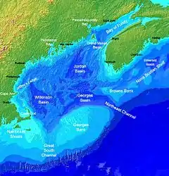
缅因湾(英語:)是大西洋西部、美国和加拿大之间的一个大海湾,湾内最大水深200米,自然环境好,又有陆上径流注入,鱼类资源丰富。美国和加拿大在60至70年代曾为该地区的大陆架划界和渔业资源发生过争执,由国际法院于80年代作出裁决解决。
| 缅因湾 | |
|---|---|
 缅因湾 | |
 | |
| 位置 | 北大西洋西岸 |
| 标 | 43°N 68°W |
| 类型 | 海湾 |
| 屬於 | 北大西洋 |
| 河流源 | 圣约翰河、佩诺布斯科特河 |
| 集水面积 | 69,000平方英里(180,000平方) |
| 所在国家 | 加拿大和美国 |
| 表面积 | 36,000平方英里(93,000平方) |
| 岛屿 | 芒特迪瑟特岛、福克斯岛(Fox Islands)、欧亚尔萨斯岛、大马南岛 |
| 波士顿、朴茨茅斯、波特兰、圣约翰 | |
参考文献
- (PDF). State of Maine, HP1629, item 1, 123rd Maine State Legislature. March 6, 2002 [September 20, 2007]. (原始内容存档 (PDF)于2016-10-21).
WHEREAS, the State of Maine is named after the Province of Maine in France...
外部链接
This article is issued from Wikipedia. The text is licensed under Creative Commons - Attribution - Sharealike. Additional terms may apply for the media files.