羅克 (堪薩斯州)
羅克()為美國堪薩斯州考利縣的一座非建制地區。海拔高度358公尺(1,175英尺),聯邦資料處理標準代碼為20-60400[1],地名系統編號為470206[1]。
| 羅克 Rock | |
|---|---|
| 非建制地區 | |
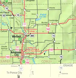
 羅克在考利縣的位置 | |
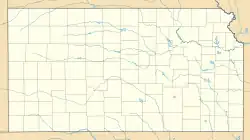
 羅克 羅克在堪薩斯州的位置 | |
| 坐标:37.4403°N 97.0064°W | |
| 國家 | 美国 |
| 州 | 堪薩斯州 |
| 縣 | 考利縣 |
| 海拔 | 358 公尺(1,175 英尺) |
| 时区 | CST(UTC-6) |
| • 夏时制 | CDT(UTC-5) |
| 郵區編號 | 67131 |
| 電話區號 | 620 |
| FIPS代碼 | 20-60400[1] |
| GNIS編號 | 470206[1] |
歷史
19世紀
此社區的郵政局於1870年8月12日開設至今[2]。位於社區附近的布赫爾橋(Bucher Bridge)已被列入至國家史蹟名錄中。
1877年,弗洛倫斯,埃爾多拉多和沃爾納特瓦利鐵路公司興建一條從弗洛倫斯至埃爾多拉多的鐵路支線;1881年,鐵路延伸至道格拉斯,最後則到阿肯色城[3]。艾奇遜,托皮卡和聖塔菲鐵路租借經營此鐵路線。從弗洛倫斯至埃爾多拉多的鐵路線已於1942年廢線[4]。原初鐵路支線為連接弗洛倫斯、伯恩斯、迪格拉夫、埃爾多拉多、奧古斯塔、道格拉斯、羅克、阿克倫、溫菲爾德及阿肯色城等地區。
參考資料
- 美國地質調查局地名資訊系統:Rock, Kansas
- . Kansas Historical Society. [6 June 2014]. (原始内容存档于2019-12-18).
- Marion County Kansas : Past and Present; Sondra Van Meter; MB Publishing House; 美国国会图书馆控制号 72-92041; 344 pages; 1972.
- . [2016-05-22]. (原始内容存档于2019-12-25).
- . [2016-05-22]. (原始内容存档于2015-05-07).
- Keystone Pipeline - Marion County Commission calls out Legislative Leadership on Pipeline Deal; April 18, 2010. 的存檔,存档日期2011年10月22日,.
- . [2016-05-22]. (原始内容存档于2021-01-17).
外部連結
- History of Rock, Kansas
- Keystone Oil Pipeline, Detailed system map (near Rock)
延伸閱讀
- 考利縣
- History of Cowley County Kansas; D.A. Millington / E.P. Greer; Winfield Courier; 162 pages; 1901. (Download 16MB PDF eBook)
- 堪薩斯州
- History of the State of Kansas; William G. Cutler; A.T. Andreas Publisher; 1883. (Online HTML eBook) (页面存档备份,存于)
- Kansas : A Cyclopedia of State History, Embracing Events, Institutions, Industries, Counties, Cities, Towns, Prominent Persons, Etc; 3 Volumes; Frank W. Blackmar; Standard Publishing Co; 944 / 955 / 824 pages; 1912. (Volume1 - Download 54MB PDF eBook), (Volume2 - Download 53MB PDF eBook), (Volume3 - Download 33MB PDF eBook)
This article is issued from Wikipedia. The text is licensed under Creative Commons - Attribution - Sharealike. Additional terms may apply for the media files.