羅素道 (安大略省)
羅素道(英語:;渥太華26號市道;皮利士葛及羅素聯合縣2號縣道)是加拿大安大略省東部的一條主幹路,西始於渥太華的河景區,向東穿過該市鄉郊地區藍斯威老、喀斯巴德斯普陵及熊溪區,並穿過加倫-洛蘭城鎮,連接契尼(Cheney)及布傑地區,東迄渥太華東部邊界上的界限道(Boundary Road)。[1]
羅素道以安大略省羅素鎮命名,因該道路在417號省道修建期間曾被用作來往羅素鎮的通路。羅素鎮則以上加拿大官員彼得·羅素命名。[2]

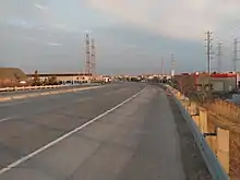
屈利道與荷塘路(Hawthorne Avenue)之間的羅素道
參考資料
- Ontario Back Road Atlas, 2011 Edition, MapArt Publishing Corp, pp. 66–67
- Nothing But Names: An Inquiry Into the Origin of the Names of the Counties and Townships of Ontario, pp. 49, 50
This article is issued from Wikipedia. The text is licensed under Creative Commons - Attribution - Sharealike. Additional terms may apply for the media files.