莱格恩山
莱格恩山(德語:),是瑞士苏黎世州的山峰,位於該國北部,山體的一部分位於阿爾高州,屬於汝拉山的一部分,處於首都蘇黎世西北面約15公里,海拔高度859米,每年平均降雨量1,854毫米。
| 莱格恩山 | |
|---|---|
 韋廷根(南面)之景觀 | |
| 最高点 | |
| 海拔 | 866(2,841英尺) |
| 地形突起度 | 425(1,394英尺) [1] |
| 地形孤立度 | 16.4(10.2英里) [2] |
| 母峰 | 特韋拉爾普峰 |
| 47°28′54″N 8°23′41″E | |
| 地理 | |
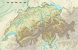 莱格恩山 瑞士地圖上的位置 | |
| 位置 | 瑞士蘇黎世州 (部分位處 阿爾高) |
| 山脈 | 汝拉山脈 |
參考資料
- Lägern on Hikr (页面存档备份,存于)
- Retrieved from the Swisstopo topographic maps. The key col is located near the Katzensee at 441 metres.
- Retrieved from Google Earth. The nearest point of higher elevation is north of the Uetliberg.
This article is issued from Wikipedia. The text is licensed under Creative Commons - Attribution - Sharealike. Additional terms may apply for the media files.