菲欣納半島
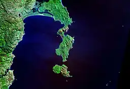
菲欣納半島(英語:),又稱為弗雷西內半島、菲辛那半島,位於澳洲塔斯曼尼亞州東岸,西臨大蠔灣,東臨塔斯曼海,南與斯考滕島隔海相望,長約23公里,寬約6.5公里,面積65平方公里。最高點菲欣納山(Mount Freycinet)海拔613米。1802年,法國探險家尼古拉·博丹測量該地,並以其副手路易·德菲欣納的姓氏命名。1916年,半島建立了菲欣納國家公園。[1]半島的主要聚居地為位於西岸的歌斯灣。
| 菲欣納半島 Freycinet Peninsula | |
|---|---|
 菲欣納半島和斯考滕島的衛星照片 | |
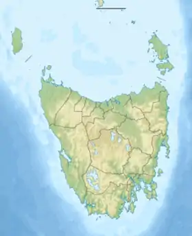
 菲欣納半島 菲欣納半島在塔斯曼尼亞州的位置 | |
| 位置 | 澳洲塔斯曼尼亞州東岸 |
| 座標 | 42°12′36″S 148°18′00″E |
| 保护地 | 菲欣納國家公園 |

位於菲欣納半島東岸的酒杯灣,菲欣納山位於右上方
參考資料
- . [2012-06-22]. (原始内容存档于2010-01-12).
This article is issued from Wikipedia. The text is licensed under Creative Commons - Attribution - Sharealike. Additional terms may apply for the media files.