蒙特港
蒙特港(西班牙語:)是智利南部湖大區的首府和港口城市,位於首都聖地亞哥以南1,055公里,2002年人口153,118,城市面積39.58平方公里,蒙特港的經濟收益主要來自農業、林業、漁業和鮭魚養殖,是智利南部發展最快速的城市。温带海洋性气候,年降水量1,600mm以上。1月份降水量约55mm,7月份降水量可超过220mm。

蒙特港全景圖

蒙特港市中心
| 蒙特港 Puerto Montt Meli Pulli | |||
|---|---|---|---|
 蒙特港市景,後方為奧索爾諾火山 | |||
| |||
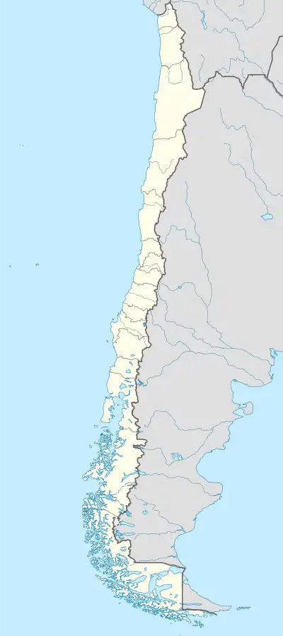
 蒙特港 在智利的位置 | |||
| 坐标:41°28′18″S 72°56′23″W | |||
| 國家 | |||
| 大區 | 湖大區 | ||
| 建城日 | 1853年2月12日 | ||
| 政府 | |||
| • 市長 | Rabindranath Quinteros Lara | ||
| 面积 | |||
| • 总计 | 1,673 平方公里(646 平方英里) | ||
| 海拔 | 14 公尺(46 英尺) | ||
| 人口(2002年) | |||
| • 總計 | 175,938人 | ||
| • 密度 | 113.9人/平方公里(295人/平方英里) | ||
| 網站 | http://www.puertomonttchile.cl | ||
气候
蒙特港的气候类型属于温带海洋性气候,全年降水充沛,但是冬季降水量明显多于夏季,全年都非常凉爽,夏天最高气温很少超过25 °C(77 °F),而冬天亦很少出现霜冻现象。极端最高气温在2019年2月录得,为35.1 °C(95.2 °F);而极端最低气温是1988年7月的−7.1 °C(19.2 °F)。
| 蒙特港(埃尔特普阿尔国际机场),(1981-2010年平均数据,1964年至今极端数据) | |||||||||||||
|---|---|---|---|---|---|---|---|---|---|---|---|---|---|
| 月份 | 1月 | 2月 | 3月 | 4月 | 5月 | 6月 | 7月 | 8月 | 9月 | 10月 | 11月 | 12月 | 全年 |
| 历史最高温 °C(°F) | 34.7 (94.5) |
35.1 (95.2) |
31.6 (88.9) |
25.8 (78.4) |
20.8 (69.4) |
20.0 (68.0) |
20.9 (69.6) |
19.9 (67.8) |
24.2 (75.6) |
24.8 (76.6) |
28.1 (82.6) |
30.4 (86.7) |
35.1 (95.2) |
| 平均高温 °C(°F) | 19.8 (67.6) |
19.7 (67.5) |
17.9 (64.2) |
15.0 (59.0) |
12.5 (54.5) |
10.5 (50.9) |
10.2 (50.4) |
11.2 (52.2) |
12.9 (55.2) |
14.5 (58.1) |
16.4 (61.5) |
18.4 (65.1) |
14.9 (58.8) |
| 日均气温 °C(°F) | 14.3 (57.7) |
13.8 (56.8) |
12.2 (54.0) |
9.9 (49.8) |
8.4 (47.1) |
6.9 (44.4) |
6.2 (43.2) |
6.7 (44.1) |
7.8 (46.0) |
9.6 (49.3) |
11.4 (52.5) |
13.3 (55.9) |
10.0 (50.0) |
| 平均低温 °C(°F) | 9.3 (48.7) |
9.0 (48.2) |
8.2 (46.8) |
6.6 (43.9) |
5.6 (42.1) |
4.3 (39.7) |
3.5 (38.3) |
3.7 (38.7) |
4.2 (39.6) |
5.6 (42.1) |
6.9 (44.4) |
8.5 (47.3) |
6.3 (43.3) |
| 历史最低温 °C(°F) | 0.8 (33.4) |
0.4 (32.7) |
−0.8 (30.6) |
−3.4 (25.9) |
−6.0 (21.2) |
−6.4 (20.5) |
−7.1 (19.2) |
−5.1 (22.8) |
−5.4 (22.3) |
−2.3 (27.9) |
−0.5 (31.1) |
−0.3 (31.5) |
−7.1 (19.2) |
| 平均降水量 mm() | 86.9 (3.42) |
70.1 (2.76) |
100.6 (3.96) |
148.3 (5.84) |
196.4 (7.73) |
219.6 (8.65) |
175.3 (6.90) |
168.0 (6.61) |
124.7 (4.91) |
127.6 (5.02) |
103.3 (4.07) |
92.3 (3.63) |
1,613.1 (63.51) |
| 平均降水天数(≥ 1.0 mm) | 10.5 | 8.5 | 11.7 | 14.9 | 17.6 | 18.9 | 17.9 | 17.8 | 15.5 | 15.4 | 13.7 | 11.4 | 173.8 |
| 平均相對濕度(%) | 79.3 | 80.9 | 84.7 | 88.5 | 90.6 | 91.4 | 90.2 | 88.2 | 85.5 | 83.4 | 81.1 | 79.8 | 85.3 |
| 月均日照時數 | 211 | 183 | 152 | 108 | 69 | 57 | 69 | 94 | 124 | 154 | 167 | 196 | 1,584 |
| 来源1:Dirección Meteorológica de Chile[1][2][3] | |||||||||||||
| 来源2:World Meteorological Organization (precipitation days and humidity 1981–2010),[4] Ogimet (sun 1981–2010)[5] | |||||||||||||
圖片集
参考文献
- . Dirección Meteorológica de Chile. [9 December 2018]. (原始内容存档于17 September 2018) (西班牙语).
- (PDF). Dirección General de Aeronáutica Civil. March 2001 [December 25, 2012]. (原始内容 (PDF)存档于17 April 2012) (西班牙语).
- . Dirección Meteorológica de Chile. [9 December 2018]. (原始内容存档于6 December 2018) (西班牙语).
- . World Meteorological Organization. [9 October 2021]. (原始内容存档于9 October 2021).
- . CLIMAT monthly weather summaries. Ogimet. [31 March 2020]. (原始内容存档于31 March 2020).
外部連結
- http://www.puertomonttchile.cl (页面存档备份,存于)
- Puerto Montt City Guide (页面存档备份,存于)
- Satellite view of Puerto Montt Google Maps
- Works on history and culture of Puerto Montt (页面存档备份,存于) by the anthropologist Wladimir Soto Cárcamo (页面存档备份,存于)
This article is issued from Wikipedia. The text is licensed under Creative Commons - Attribution - Sharealike. Additional terms may apply for the media files.


