農呀曬縣
農呀曬縣(泰語:,发音:[nɔ̌ːŋ jâː sāj])或農亞賽縣,是位於泰國素攀武里府西部的縣。
| 農呀曬 หนองหญ้าไซ | |
|---|---|
| 縣 | |
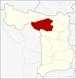
 農呀曬縣在素攀府的位置 | |
| 坐标:14°46′30″N 99°54′40″E | |
| 國家 | |
| 府 | 素攀府 |
| 面积 | |
| • 总计 | 420.2 平方公里(162.2 平方英里) |
| 人口(2013) | |
| • 總計 | 49,272人 |
| • 密度 | 118.7人/平方公里(307人/平方英里) |
| 时区 | 印度支那時間(UTC+7) |
| 郵政編碼 | 72240 |
| 地理編碼 | 7210 |
參考資料
- (PDF). Royal Gazette. May 21, 1990, 107 (83 ก special): 1–4 [2021-06-11]. (原始内容 (PDF)存档于2022-03-29) (泰语).
外部鏈接
- amphoe.com (页面存档备份,存于)
This article is issued from Wikipedia. The text is licensed under Creative Commons - Attribution - Sharealike. Additional terms may apply for the media files.