達令赫斯特
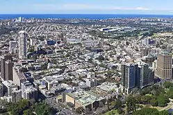
達令赫斯特[2](英語:)位於澳大利亞新南威爾士州,緊貼悉尼中心商業區東面的高密度住宅區,多數居民生活於公寓和排屋中[3]。該處曾經為貧民區和紅燈區,自1980年代以來,達令赫斯特經歷了城市更新,成為國際大都市的一部分。區內的維多利亞街、史丹利街和皇冠街都充滿着濃厚的文化氣息[4]。
| 達令赫斯特 Darlinghurst | |
|---|---|
 達令赫斯特鳥瞰圖 | |
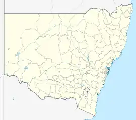
 達令赫斯特 | |
| 坐标:33°53′00″S 151°13′30″E | |
| 国家 | |
| 一级行政区 | 新南威爾士州 |
| 地方政府区域 | 悉尼市 |
| 面积 | |
| • 总计 | 0.8 平方公里(0.3 平方英里) |
| 人口(2016年普查)[1] | |
| • 總計 | 11,320人 |
| • 密度 | 11,470.0人/平方公里(29,707人/平方英里) |
| 郵政編碼 | 2010 |
| 位置 | 1(0.62英里) (距悉尼中心商業區東) |
| 城市 | 悉尼 |
| 州選區 | 悉尼選舉區 |
| 聯邦選區 | 悉尼 |
人口
據2016年人口普查,達令赫斯特的人口為11,320人,當中57.8%為男性,42.2%為女性。男性比例較國民平均值的49.3%為高。45.2%的居民於澳大利亞出生。其他常見出生地包括:英國(6.1%)、紐西蘭(3.8%)、泰國(2.2%)、美國(2.0%)和中國(1.6%)[1]。
參考
- Australian Bureau of Statistics. . 2016 Census QuickStats. 27 June 2017 [2017-07-02].
- . 民國報 Chinese Republic News. 1932-12-31 [2024-03-23].
- Gregory's Sydney Street Directory, Gregory's Publishing Company, 2007
- Heritage of Australia, Published by Macmillan Company, (1981), p.2/83
伸延閱讀
- Apperly, Richard; Irving, Robert; Reynolds, Peter (1989). A Pictorial Guide to Identifying Australian Architecture: Styles and Terms from 1788 to the Present. Sydney, Angus & Robertson. ISBN 0-207-18562-X
- Faro, Clive (2000). Street Seen: A History of Oxford St. Carlton South, Melbourne University Press. ISBN 0-522-84967-9
- Jahn, Graham (1997). Sydney Architecture. Sydney, The Watermark Press. ISBN 0-949284-32-7
外部連結
| 维基共享资源上的相关多媒体资源:達令赫斯特 |
- Sydney City Council (页面存档备份,存于)
- Dunn, Mark. . Dictionary of Sydney. 2011 [2015-09-26]. (原始内容存档于2021-05-15). [CC-By-SA]
- Dunn, Mark. . Dictionary of Sydney. Dictionary of Sydney Trust. 2008 [2015-10-11].[CC-By-SA]
- Wotherspoon, Garry. . Dictionary of Sydney. 2010 [2015-09-27]. (原始内容存档于2021-03-29). [CC-By-SA]
- . Dictionary of Sydney. 2008 [2015-10-09]. (原始内容存档于2021-03-29). [CC-By-SA]
This article is issued from Wikipedia. The text is licensed under Creative Commons - Attribution - Sharealike. Additional terms may apply for the media files.