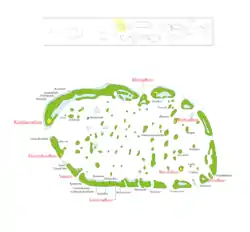
達魯環礁
達魯環礁(迪維希語:),是馬爾代夫的行政環礁,由56個島嶼(其中7座有人居住)形成。在2014年,該環礁的人口約有7,442人。[1]
| 達魯環礁 | |
|---|---|
| 行政環礁 | |
 | |
| 坐标:2°54′N 72°54′E | |
| 國家 | 馬爾代夫 |
| 治府 | Kudahuvadhoo |
| 面积 | |
| • 总计 | 2.57 平方公里(0.99 平方英里) |
| 人口 | 7,442人 |
| 时区 | 馬爾代夫標準時間(UTC+5) |
達魯環礁是行政環礁,僅為行政區劃,並不是自然環礁。一如其他行政環礁,這些名稱並不能精確地從地理或文化上劃分馬爾代夫。[2]
參考資料
- . [2017-01-01]. (原始内容存档于2016-11-08).
- Tim Godfrey, Atlas of the Maldives, Atoll Editions 2004
外部鏈結
達魯環礁官方介紹(英語) (页面存档备份,存于)
This article is issued from Wikipedia. The text is licensed under Creative Commons - Attribution - Sharealike. Additional terms may apply for the media files.