阿尔布拉瑟丹
阿尔布拉瑟丹(荷蘭語:,荷兰语:[ɑlˌblɑsərˈdɑm] (ⓘ))是荷兰南荷兰省的一个市镇。2009年该市镇人口19,003。该市镇面积9.96 km²,其中1.18 km²为水域。阿尔布拉瑟丹是德雷赫茨泰登(Drechtsteden)的一部分。金德代克(Kinderdijk)村的一部分属于阿尔布拉瑟丹。
| 阿尔布拉瑟丹 Alblasserdam | |||
|---|---|---|---|
| 市镇 | |||
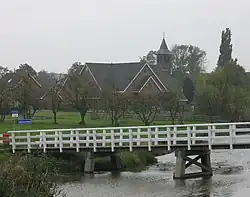
 教堂 | |||
| |||
.svg.png.webp) Location in South Holland | |||
| 坐标:51°52′N 4°39′E | |||
| 国家 | |||
| 省份 | 南荷兰省 | ||
| 政府[1] | |||
| • 行政机构 | 市议会 | ||
| • 市长 | Jaap Paans (VVD) | ||
| 面积[2] | |||
| • 总计 | 10.06 平方公里(3.88 平方英里) | ||
| • 陸地 | 8.78 平方公里(3.39 平方英里) | ||
| • 水域 | 1.28 平方公里(0.49 平方英里) | ||
| 海拔[3] | 4 公尺(13 英尺) | ||
| 人口(1月 2019)[4] | |||
| • 總計 | 20,069人 | ||
| • 密度 | 2,286人/平方公里(5,920人/平方英里) | ||
| 居民称谓 | Alblasserdammer | ||
| 时区 | CET(UTC+1) | ||
| • 夏时制 | CEST(UTC+2) | ||
| 邮政编码 | 2950–2954 | ||
| 电话区号 | 078 | ||
| 網站 | www | ||
注释
- [Task distribution]. Bestuur en Organisatie. Gemeente Alblasserdam. [15 June 2013]. (原始内容存档于24 June 2013) (荷兰语).
- [地区关键统计数字]. 荷蘭中央統計局统计数据. 荷蘭中央統計局. 2013-07-02 [2014-03-12] (荷兰语).
- . Actueel Hoogtebestand Nederland. Het Waterschapshuis. [16 June 2013]. (原始内容存档于21 September 2013) (荷兰语).
- [Population growth; regions per month]. 荷蘭中央統計局统计数据. 荷蘭中央統計局. 1 January 2019 [2019年1月1日] (荷兰语).
外部链接
- Official website
- Alblasserdam News in Dutch (页面存档备份,存于)
- https://web.archive.org/web/20110604225710/http://www.plattegronden.nl/alblasserdam/
This article is issued from Wikipedia. The text is licensed under Creative Commons - Attribution - Sharealike. Additional terms may apply for the media files.

