麦盖提县
麦盖提县是中国新疆维吾尔自治区喀什地区所辖的一个县。总面积为10927平方公里,常住人口約23万人。
| 麦盖提县 | |
|---|---|
| 县 | |
.png.webp) 麦盖提县的地理位置 | |
| 坐标:38°54′10″N 77°39′00″E | |
| 国家 | |
| 隶属行政区 | 新疆维吾尔自治区喀什地区 |
| 政府駐地 | 麦盖提镇 |
| 下级行政区 | |
| 面积 | |
| • 总计 | 10,882.99 平方公里(4,201.95 平方英里) |
| 人口(2020年) | |
| • 總計 | 22.42万人 |
| 民族 | |
| • 民族比例 | 維吾爾族[1] |
| 时区 | 北京时间(UTC+8) |
| 新疆時間(UTC+6) | |
| 電話區號 | 998 |
| 車輛號牌 | 新Q |
| 行政区划代码 | 653127 |
| 網站 | 麦盖提县政府网 |
行政区划

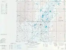
包括麥蓋提(MARKIT MAI-KAI-T'I)的地圖(DMA, 1980)
麦盖提镇、巴扎结米镇、希依提墩乡、央塔克乡、吐曼塔勒乡、尕孜库勒乡、克孜勒阿瓦提乡、库木库萨尔乡、昂格特勒克乡、库尔玛乡、胡杨林场、麦盖提县园艺场和五一林场。
文化
麦盖提县是知名的“刀郎文化之乡”,其“刀郎木卡姆”是中国国家级非物质文化遗产[4]。
参考文献
- James Leibold and Adrian Zenz. . Foreign Policy. 2016年12月23日 [2020年4月9日]. (原始内容存档于2021年5月1日) (英语).
On the edge of the Taklamakan Desert, for example, Makit county (81 percent Uyghur) is building 61 convenience police stations, including 14 in each of its rural townships.
参数|journal=与模板{{cite web}}不匹配(建议改用{{cite journal}}或|website=) (帮助) - . 中华人民共和国国家统计局. 2023-06-30 (中文(中国大陆)).
- . www.citypopulation.de. [2023-12-25].
- . 中国广播网. 2012-06-20 [2012-06-20]. (原始内容存档于2019-08-30) (中文(简体)).
This article is issued from Wikipedia. The text is licensed under Creative Commons - Attribution - Sharealike. Additional terms may apply for the media files.