罗斯属地
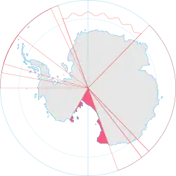
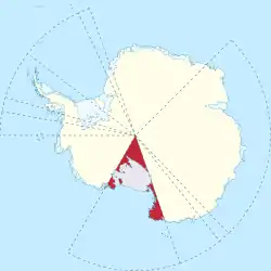
罗斯属地(英語:)是一块新西兰在南极洲(以及其它在南冰洋的分散领土)声称拥有的地区。这块领地的范围是从南极点出发的一个扇形,沿着160°东经线至150°经线之间向北延伸,终结在60°南纬线。罗斯属地的名字是来自发现罗斯海的詹姆斯·克拉克·罗斯爵士()。
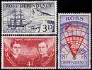
罗斯属地1957年第一次发行的邮票
| 罗斯属地 Ross Dependency | |
|---|---|
 旗帜
 徽章
| |
 | |
 | |
| 主要基地 | |
| 新西兰属地 | |
| 1923年 | |
• 范围 | 东经160度 – 西经150度 |
| 面积 | |
• 总计 | 450,000平方公里 |
| 人口 | |
• 季节性估计 |
|
| 货币 | 新西兰元(NZD) |
| 时区 | UTC+12(新西兰时间) |
• 夏令时 | UTC+13(新西兰夏令时间) |
| (九月到次年四月) | |
| 电话区号 | +64 2409 |
| ISO 3166码 | AQ |
| 互联网顶级域 | |
.svg.png.webp) | |
罗斯属地包括部分维多利亚地以及大部分罗斯冰架,如同冰雪覆盖的罗斯福岛一样,罗斯岛、巴勒尼群岛和小斯科特岛也共同构成属地的領地。
.svg.png.webp)
参考文献
外部链接
- 罗斯属地政府 — 官方描述
- Antarctica New Zealand (页面存档备份,存于) — Crown entity charged with administering, developing and managing Ross Dependency
- 50 years of Scott Base (页面存档备份,存于)
- History - From University of Canterbury (页面存档备份,存于)
- South-Pole.com: Arctic & Antarctic History on the Net (页面存档备份,存于)
- Stamps of Ross Dependency
- map of Ross Dependency (central part)
- Scientific Research by NIWA in Antarctica
- Dominion Post Photos of Antarctica: enter, go to Categories:Places;Antarctica
This article is issued from Wikipedia. The text is licensed under Creative Commons - Attribution - Sharealike. Additional terms may apply for the media files.