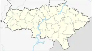
萨拉托夫州
萨拉托夫州(俄语:,羅馬化:),位於东欧平原东南部,东南与哈萨克斯坦共和国接壤。是俄羅斯聯邦主體之一,屬伏爾加聯邦管區。面積100,200平方公里,人口2,463,950(2018年)。
| 萨拉托夫州 | |||
|---|---|---|---|
| 州 | |||
| Саратовская область | |||
| |||
| 颂歌:无[1] | |||
 | |||
 萨拉托夫州 | |||
| 坐标:51°47′N 46°44′E | |||
| 国家 | |||
| 联邦管区 | 伏尔加联邦管区[2] | ||
| 经济地区 | 伏尔加经济地区[3] | ||
| 建立 | 1936年12月5日[4] | ||
| 行政中心 | 萨拉托夫[5] | ||
| 政府 | |||
| • 行政机构 | 萨拉托夫州杜马[6] | ||
| • 州长[6] | 罗曼·布萨尔金 | ||
| 面积[7] | |||
| • 总计 | 100,200 平方公里(38,700 平方英里) | ||
| 面积排名 | 36 | ||
| 人口(2010年普查) | |||
| • 总计 | 2,521,892人 | ||
| • 排名 | 19 | ||
| • 密度 | 25.2人/平方公里(65.2人/平方英里) | ||
| • 市区 | 74.5% | ||
| • 乡村 | 25.5% | ||
| 时区 | 萨马拉时间 | ||
| ISO 3166码 | RU-SAR | ||
| 车牌 | 64, 164 | ||
| 官方语言 | 俄语[lower-roman 1] | ||
| 区划代码 | 63000000 | ||
| 網站 | http://saratov.gov.ru/ | ||
| |||
行政区划
| 层次 | 行政模式 | 自治体模式 |
|---|---|---|
| 上层 (联邦主体辖) |
|
|
| 下层 (地区辖) |
|
|
註釋
参考资料
- The official symbols of Saratov Oblast, enumerated in Article 4 of the Charter of Saratov Oblast, include only its flag and coat of arms.
- (President of the Russian Federation. Decree #849 of May 13, 2000 On the Plenipotentiary Representative of the President of the Russian Federation in a Federal District. Effective as of May 13, 2000).
- (Gosstandart of the Russian Federation. #OK 024-95 December 27, 1995 Russian Classification of Economic Regions. 2. Economic Regions, as amended by the Amendment #5/2001 OKER. ).
- Charter of Saratov Oblast, Preamble
- Charter of Saratov Oblast, Article 10.4
- Charter of Saratov Oblast, Article 6
- Федеральная служба государственной статистики (Federal State Statistics Service). . Всероссийская перепись населения 2002 года (All-Russia Population Census of 2002). Federal State Statistics Service. 2004-05-21 [2011-11-01] (俄语).
- . Официальный интернет-портал правовой информации. 2011-06-03 [2019-01-19] (俄语).
This article is issued from Wikipedia. The text is licensed under Creative Commons - Attribution - Sharealike. Additional terms may apply for the media files.

