Érsekhalma | |
|---|---|
 Érsekhalma Location of Érsekhalma | |
| Coordinates: 46°21′00″N 19°07′00″E / 46.3500°N 19.1167°E | |
| Country | |
| County | Bács-Kiskun |
| Area | |
| • Total | 27.56 km2 (10.64 sq mi) |
| Population (2005) | |
| • Total | 702 |
| • Density | 25.47/km2 (66.0/sq mi) |
| Time zone | UTC+1 (CET) |
| • Summer (DST) | UTC+2 (CEST) |
| Postal code | 6348 |
| Area code | 78 |
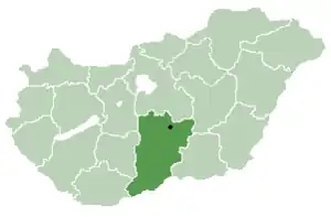
Location of Bács-Kiskun
county in Hungary
Érsekhalma (Croatian: Loma) is a village in Bács-Kiskun county, in the Southern Great Plain region of Hungary.
Geography
It covers an area of 25.47 km2 (10 sq mi) and has a population of 702 people (2005).
Partnership


46°21′N 19°07′E / 46.350°N 19.117°E
This article is issued from Wikipedia. The text is licensed under Creative Commons - Attribution - Sharealike. Additional terms may apply for the media files.