Étueffont | |
|---|---|
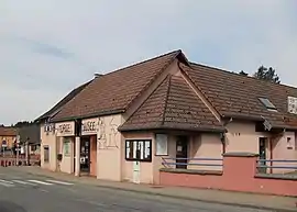
 Forge Museum | |
 Coat of arms | |
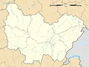
Location of Étueffont | |
 Étueffont  Étueffont | |
| Coordinates: 47°43′11″N 6°55′21″E / 47.7197°N 6.9225°E | |
| Country | France |
| Region | Bourgogne-Franche-Comté |
| Department | Territoire de Belfort |
| Arrondissement | Belfort |
| Canton | Giromagny |
| Intercommunality | Vosges du Sud |
| Government | |
| • Mayor (2020–2026) | Alain Fessler[1] |
| Area 1 | 12.53 km2 (4.84 sq mi) |
| Population | 1,394 |
| • Density | 110/km2 (290/sq mi) |
| Time zone | UTC+01:00 (CET) |
| • Summer (DST) | UTC+02:00 (CEST) |
| INSEE/Postal code | 90041 /90170 |
| Elevation | 399–915 m (1,309–3,002 ft) |
| 1 French Land Register data, which excludes lakes, ponds, glaciers > 1 km2 (0.386 sq mi or 247 acres) and river estuaries. | |
Étueffont (French pronunciation: [etyfɔ̃]; German: Staufen) is a commune in the Territoire de Belfort department in Bourgogne-Franche-Comté in northeastern France.
History
The separate villages of Étueffont-Bas (founded in the 16th century, with 28 families in 1760) and Étueffont-Haut (founded in the 12th century, with 38 families in 1760) were merged into the current commune on 12 June 1973.
Geography
The town sits at the foot of the Vosges mountains on the banks of the river Madeleine, in the Regional Natural Park Les Ballons des Vosges.
Sights
In the village center an 18th-century smithy houses a Forge Museum[3] that commemorates four generations of blacksmiths working in the village from 1843 to 1977.
See also
Wikimedia Commons has media related to Étueffont.
References
- ↑ "Répertoire national des élus: les maires" (in French). data.gouv.fr, Plateforme ouverte des données publiques françaises. 13 September 2022.
- ↑ "Populations légales 2021". The National Institute of Statistics and Economic Studies. 28 December 2023.
- ↑ The Forge Museum website (in French)
This article is issued from Wikipedia. The text is licensed under Creative Commons - Attribution - Sharealike. Additional terms may apply for the media files.