| Ģedule Ģedulis | |
|---|---|
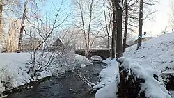
 Bridge over Ģedule in Iecava | |
| Location | |
| Municipality | Bauska Municipality |
| Country | Latvia |
| Physical characteristics | |
| Source | Dreimaņi swamp |
| • location | 56°30′16″N 24°14′00″E / 56.50444°N 24.23333°E |
| Mouth | Iecava |
• location | 56°35′34″N 24°11′46″E / 56.59278°N 24.19611°E |
| Length | 11km |
| Basin size | 30.5 km² |
| Basin features | |
| Cities | Iecava |
| Bridges | Upes Iela, Iecava, Latvia |
Ģedule (also Ģedulis) [1] is a tributary of the left bank of Iecava in Bauska Municipality. It begins as a district ditch on the western edge of Dreimaņi marsh, south of Tāma. It flows along the Semigallia plain mainly in the north direction, collecting the waters of the surrounding marshes. The river is regulated in most of its course, except for a small section before the mouth. It flows into the Iecava river in Iecava near Dartija.[2]
References
This article is issued from Wikipedia. The text is licensed under Creative Commons - Attribution - Sharealike. Additional terms may apply for the media files.